Written by NOAH Hazard Assessment Team
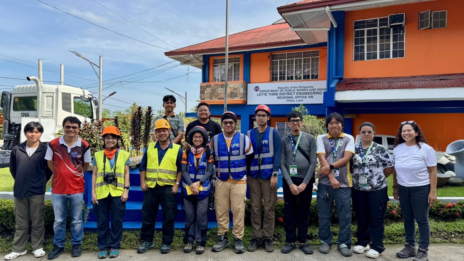
The UP Quick Response Team, comprised of the UP Resilience Institute–NOAH Center (UPRI-NOAH), the UP National Institute of Geological Sciences (UP-NIGS), and the UP Institute of Civil Engineering (UP-ICE), conducted a post-earthquake assessment on 03-07 October 2025 following the M6.9 earthquake in Cebu. Made possible with the support of Leyte 3rd District Representative Anna Veloso Tuazon, the assessment focused on evaluating the damage and impacts of the event in its constituent municipalities.
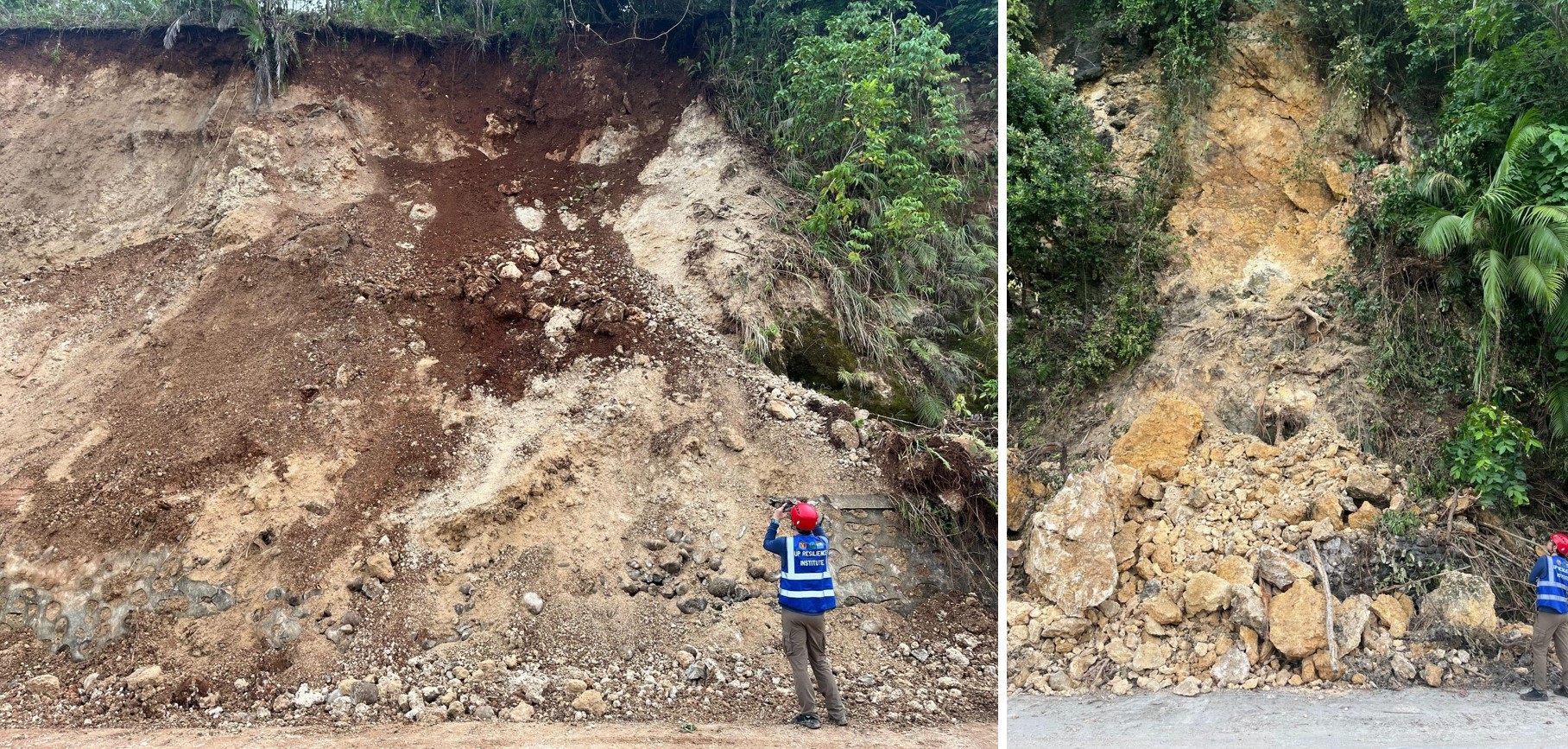
With the assistance of the local government units and the Mines and Geosciences Bureau (MGB) Region VIII, UPRI-NOAH and UP-NIGS inspected reported road cracks, rockfalls, and other landslides across the district. The team identified roadcut landslides as one of the most common earthquake-related hazards in the area. Many of these slopes were likely weakened by Typhoon Bualoi (locally “Opong”) before the earthquake. The team also inspected an elementary school in Palarao and a sitio in Barangay Kawayan, both in Leyte, Leyte, where debris flows composed of poorly sorted materials, ranging from sand to boulder-sized clasts, caused significant property damage. The debris traveled more than 300 meters downslope, leaving a clear runout path of destruction. In areas that were difficult to reach due to thick vegetation, but where locals reported rockfall noises, drones were deployed to survey the slopes. Barangay officials were also briefed on the potential landslide risks observed during the site inspections.
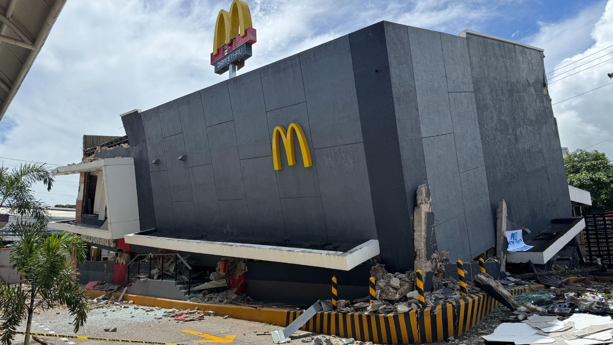
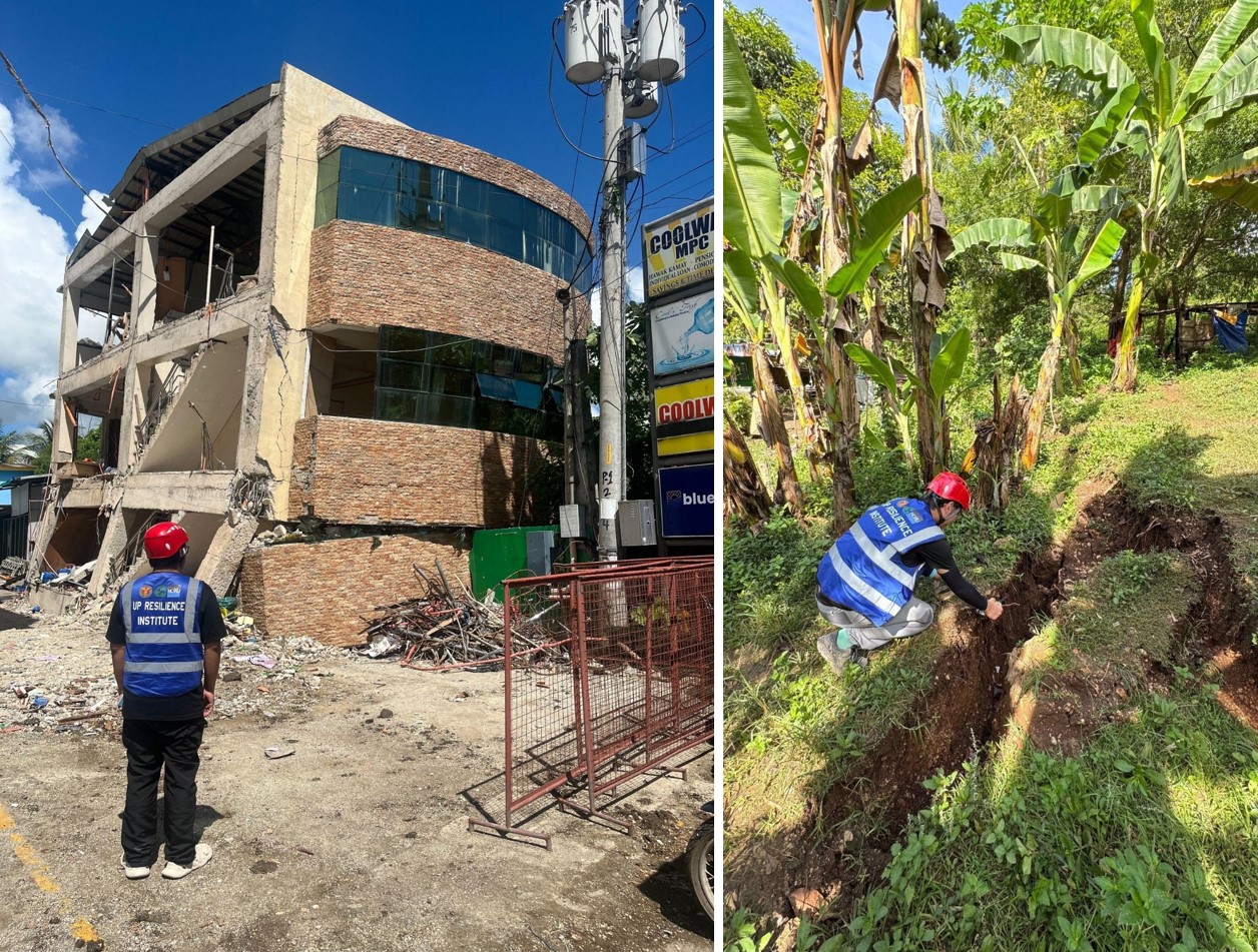
The UP-ICE team carried out an impact assessment of damaged critical facilities and infrastructure, offering guidance on which buildings were deemed safe for immediate use and which required further work before reoccupation. The aim was to equip local decision makers with a clear and actionable foundation for public safety and urgent repairs.
After completing the Leyte assessment, the UPRI-NOAH and UP-NIGS proceeded to Cebu to inspect the ground zero of the earthquake. Along the route from Danao Port to Bogo City, visible signs of earthquake damage were observed, and displaced families were seen extending for several kilometers near Bogo. Numerous earthquake-induced landslides occurred along slopes composed of soft limestone, where boulder-sized debris from rockfalls was also documented. The team conducted drone surveys in Tabogon to identify any potential manifestations of surface fault rupture in the area.
Within Bogo City, several buildings were inspected, with most damage attributed to soft soil conditions and structural collapse due to heavy loads. The results were correlated with the Project NOAH hazard maps, revealing that many of the affected structures were located in high-risk zones identified in the database. The team also visited the onshore manifestation of the fault. Aerial drone mapping was conducted to trace the fault’s extent from the shores of Brgy. Nailon inland. Further analyses of the drone imagery were performed to better understand the fault mechanism and related geologic processes responsible for the destructive earthquake. Residents living near the fault trace were advised to avoid the area temporarily, as aftershocks were still occurring during the assessment period.
Through this joint field assessment, the UP Quick Response Teams reaffirm their commitment to science-based hazard assessment and disaster preparedness, providing data-driven insights to help local governments and communities reduce disaster risks in earthquake-affected areas.