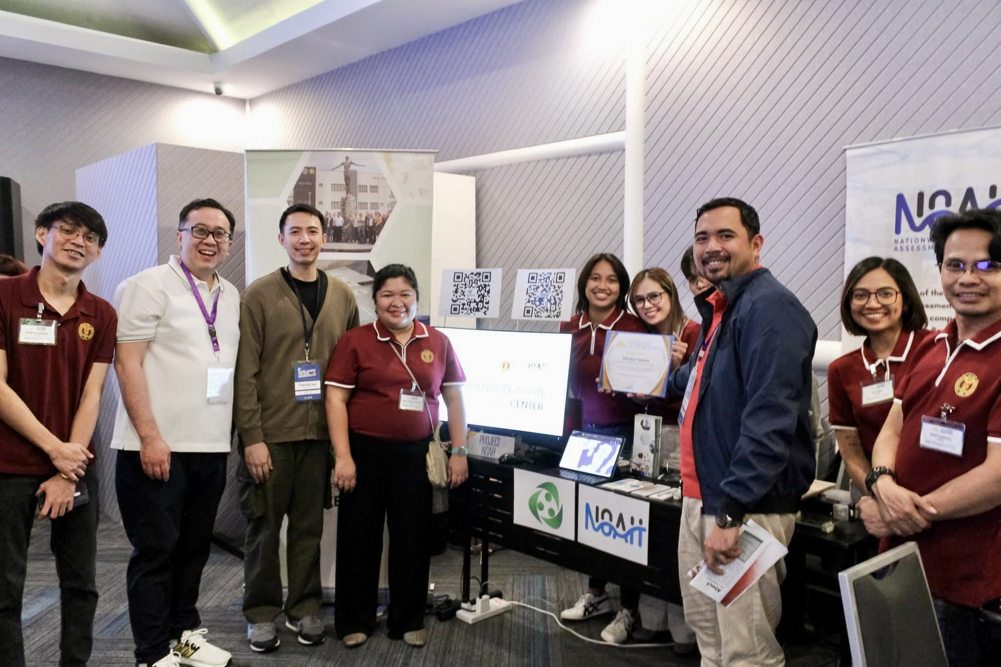
On January 30, 2026, the UP Resilience Institute (UPRI) participated in the Jesse M. Robredo Foundation Development Marketplace at B Hotel, Quezon City. The event convened development leaders, partner institutions, and local government representatives committed to good governance, sustainable development, and community empowerment.
UPRI was represented by members of the WebGIS Team, Knowledge Sharing Division, and the Seismology Team, who engaged local officials and partners throughout the day through live demonstrations and technical discussions.
Showcasing Science-Driven Innovation for Resilience
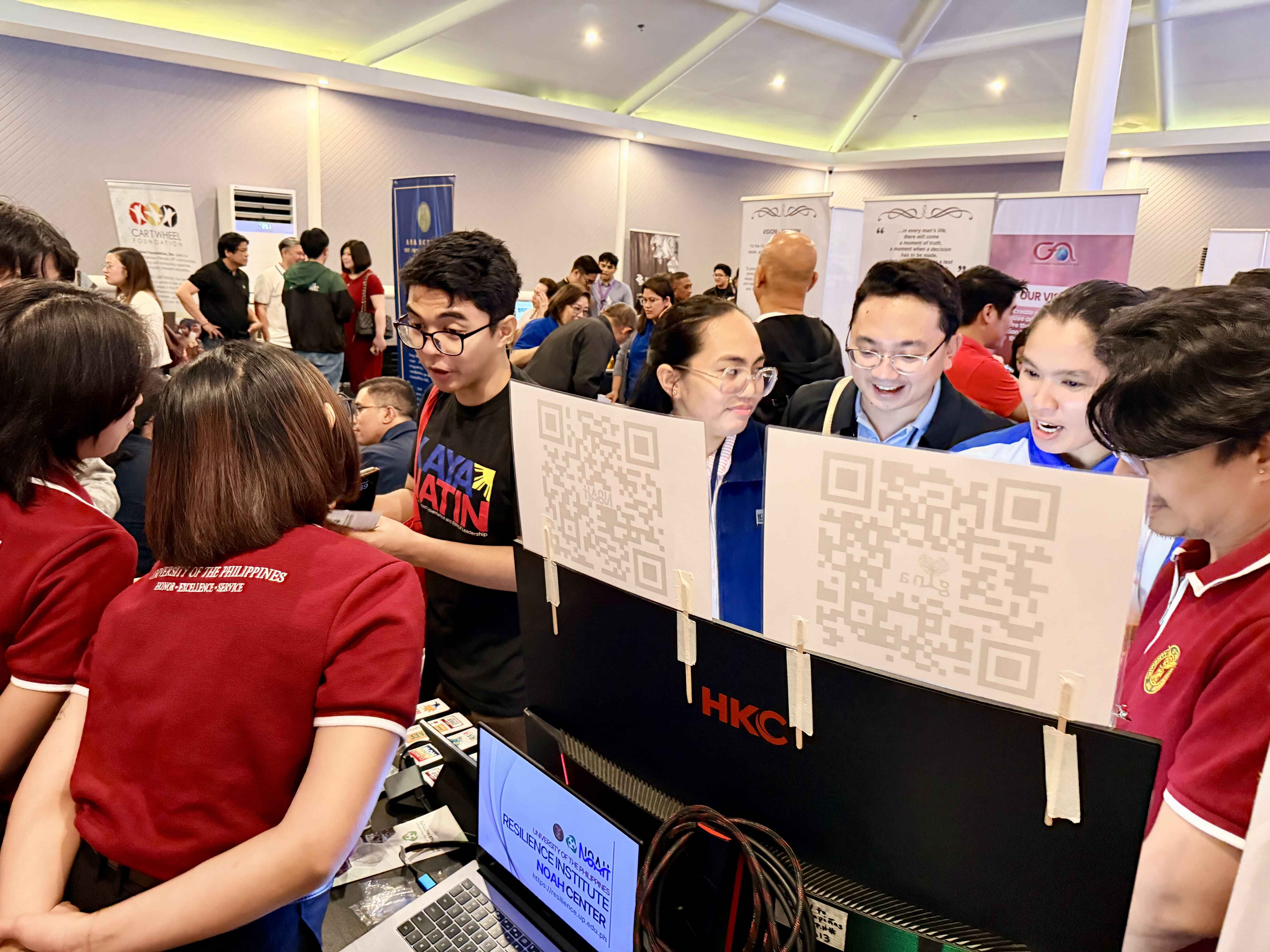
At the booth, UPRI showcased three core innovations that support disaster risk reduction, environmental sustainability, and resilience planning: the Nationwide Operational Assessment of Hazards (NOAH) platform, the Grow and Identify Native Trees in Your Area (GINA) platform, and an interactive Shake Table demonstration. These innovations illustrated how scientific data, geospatial technologies, and hands-on learning approaches can support risk-informed governance and sustainable development at the local level.
Through guided walkthroughs and live demonstrations, local officials explored how these tools can be integrated into evidence-based decision-making, disaster preparedness strategies, and environmental programs.
NOAH: Enabling Science-Based Disaster Resilience
Local government officials from various municipalities visited the UPRI booth to explore how the NOAH Application supports risk-informed governance and disaster preparedness. Through guided demonstrations, officials were introduced to NOAH’s features, including:
- Near real-time weather updates and rainfall monitoring
- Flood, landslide, storm surge, and typhoon track visualization
- Impact-Based Flood Forecasting System
Officials expressed interest in how NOAH translates complex scientific data into accessible, actionable information that can inform local planning, emergency response coordination, and evidence-based decision-making.

GINA: Supporting Climate Adaptation and Biodiversity
Alongside NOAH, UPRI also showcased GINA, an innovative geospatial platform that supports environmental sustainability and climate adaptation. GINA enables users to:
- Identify native tree species suitable for specific locations
- Support science-based reforestation and urban greening initiatives
- Strengthen climate adaptation initiatives
- Enhance environmental education efforts
Local leaders highlighted the potential of GINA to complement existing greening programs and community-based environmental initiatives.
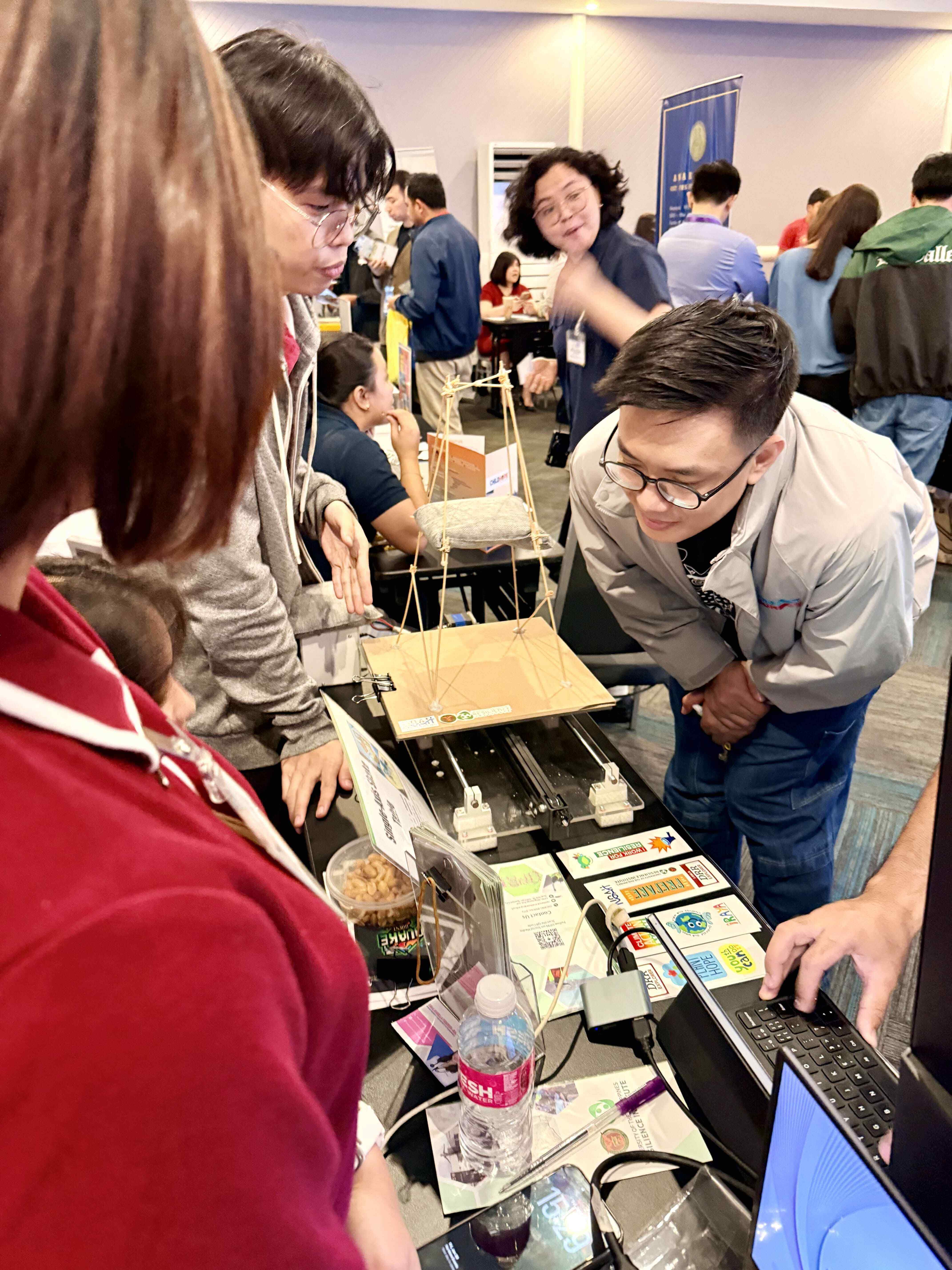
Shake Table: Making Earthquake Science Tangible
Another highlight of the UPRI booth was the demonstration of the interactive Shake Table, designed and built by an engineer from the UPRI Seismology Team. The Shake Table serves as an interactive educational tool that simulates earthquake ground motion, allowing participants to observe how different structural designs respond to seismic activity.
Local officials and visitors were highly engaged during the demonstrations, gaining practical insights into:
- The importance of structural integrity and building design
- How ground shaking affects various types of structures
- The value of earthquake preparedness and mitigation measures
The Shake Table translated seismic science into a tangible learning experience, reinforcing the importance of science-based disaster risk reduction.
Strengthening Local Partnerships
A key outcome of the event was the engagement of representatives from 30 local government units, who expressed interest in exploring partnerships with UPRI. The attendees recognized the value of integrating NOAH and GINA, along with capacity-building tools such as the Shake Table, into their municipal disaster resilience, climate adaptation, and environmental mitigation programs.
The conversations reflected a shared commitment to building safer, more innovative, and more sustainable communities that are grounded in science.
Moving Forward
The Developmental Marketplace was more than a platform for showcasing innovations; it served as a reminder that resilience is built through partnerships. By bringing together institutions, foundations, and local governments, the event created opportunities for meaningful collaboration toward inclusive and sustainable development.
UPRI remains committed to supporting local governments and communities through research-driven solutions, capacity building, and innovative geospatial technologies. Through knowledge sharing, scientific innovation, and strong partnerships, we move closer to achieving disaster-resilient and environmentally sustainable communities across the Philippines.