by UP NOAH Center – Planning Component
Small island communities like Batanes are on the frontline of climate change. This story highlights how science, local governance, and indigenous knowledge converge in a recent workshop that equips stakeholders with tools for multi-hazard risk assessment and climate resilience.
The escalating impacts of climate change continue to magnify the vulnerabilities of small island communities across the globe. In the Philippines, the province of Batanes—a geographically isolated cluster of islands at the country’s northernmost tip—is taking proactive steps to strengthen its defenses against climate-related risks through science-based and community-driven action.
As part of the project “Bridging Academic Researchers and Vulnerable Island Communities in the Philippines: Enhancing the Climate and Disaster Risk Management Capacities of Municipalities in Batanes, Philippines,” the University of the Philippines Resilience Institute (UP RI) and the local government units (LGUs) of Batanes convened Workshop 2: Enhancing Skills in Multi-Scenario, Multi-Hazard Assessment and Climate and Disaster Risk Assessment (CDRA) on May 22–23, 2025.
The workshop brought together local government stakeholders from Batanes’ six municipalities—Basco, Itbayat, Ivana, Mahatao, Sabtang, and Uyugan—alongside representatives from the Provincial Government of Batanes, Department of Human Settlements and Urban Development Region II (DHSUD), Department of the Interior and Local Government Region II (DILG), and the National Museum of the Philippines – Batanes.
Designed to equip local leaders with practical tools for risk-informed planning, the two-day workshop introduced key methodological approaches in climate and disaster risk assessment. Participants engaged in lectures, interactive sessions, and group exercises that combined scientific methods with participatory planning processes.
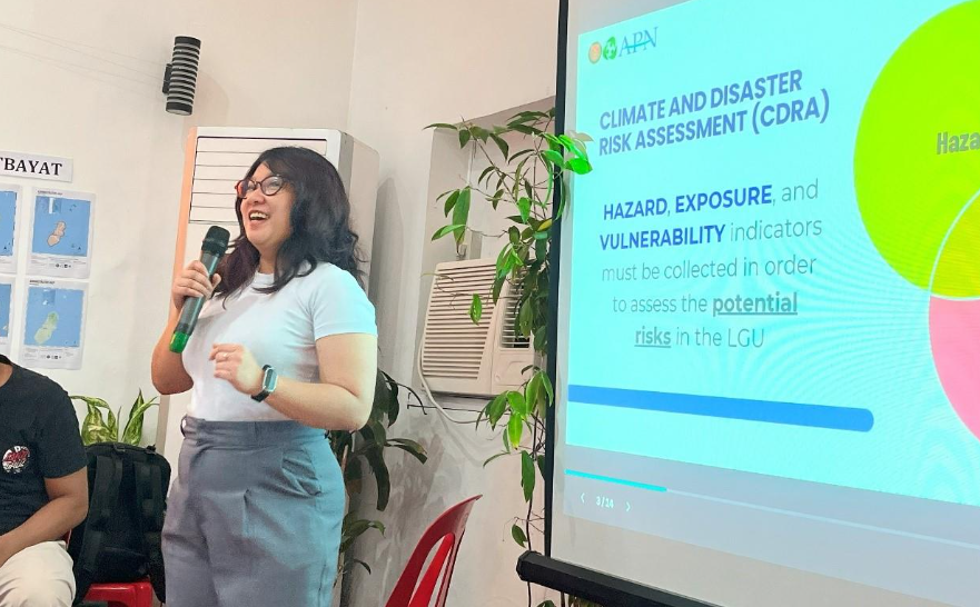
Ms. Donna Maquimot of DHSUD Region II opened the technical discussions with an Introduction to Climate and Disaster Risk Assessment, emphasizing the importance of mainstreaming CDRA into local government planning.
EnP. Charlie E. Cabotaje of the UP National College of Public Administration and Governance then guided participants through the first step of CDRA: Collecting and Analyzing Climate and Hazard Information and Policies.
“When we talk about climate and disaster risk assessment, we are essentially trying to answer the question: What are we up against—and what tools, systems, and policies are already in place to help us respond? This lecture is about laying the groundwork for those answers,” Cabotaje explained.
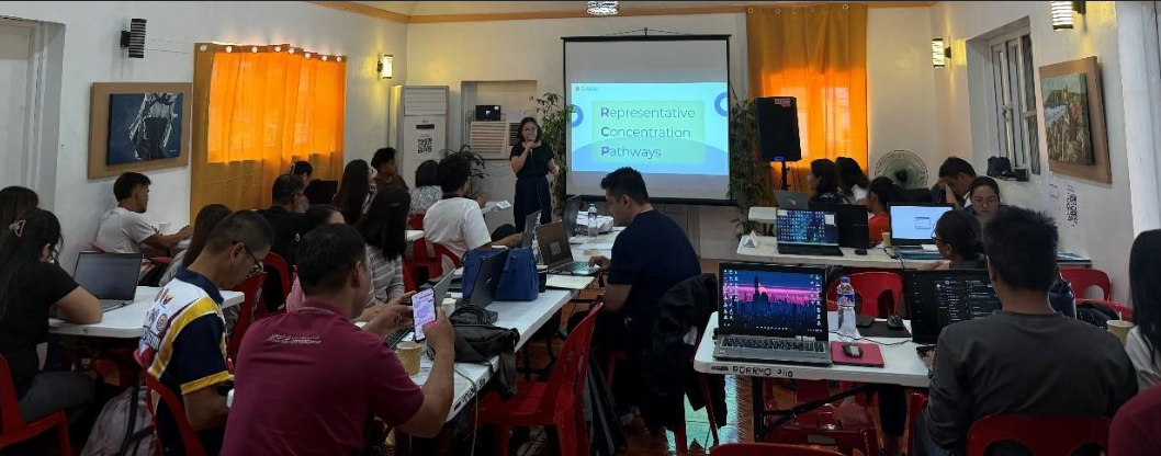
From there, Ms. Claire Mandar, together with Ms. Patricia Anne Delmendo and Ms. Lea Serrano of UP RI, presented the activities for collecting and organizing climate and hazard information, including high-resolution hydrometeorological hazard maps of the Batanes islands, alongside geologic hazard assessments.
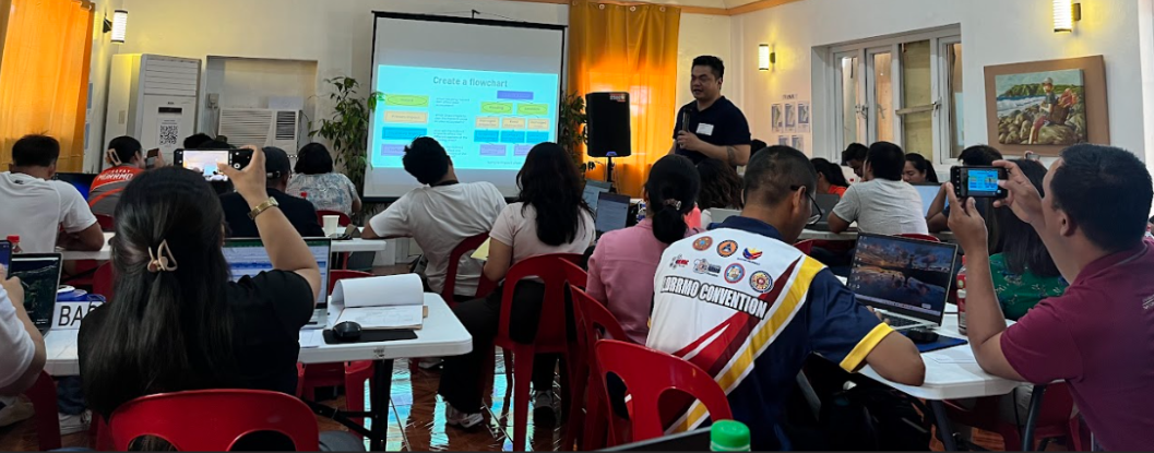
The second CDRA step, scoping potential hazard impacts, was introduced by Mr. Tedrick Danao of DILG Batanes. He emphasized how various sectors—such as agriculture, settlements, and infrastructure—stand to be affected by climate change. To translate theory into practice, Mr. Geoel Anthony Esguerra of National Center for Transportation Studies UP Diliman facilitated the Impact Chain Diagram activity, where participants assessed the potential impacts of increasing temperatures, changing rainfall patterns, and sea-level rise.
The third CDRA step, exposure database development, was introduced by Dr. Mario R. Delos Reyes, faculty and former dean of the UP School of Urban and Regional Planning, who underscored the human dimension of technical tasks:
“It’s where we document who and what could be affected, where they are located, and how much is potentially at stake. Though technical, it’s ultimately about people. By identifying what’s exposed, we’re one step closer to protecting lives, sustaining livelihoods, and ensuring resilient development for our communities.”
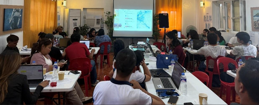
This was followed by a session on developing exposure databases led by Ms. April Dawn Tegelan of UP RI. LGU representatives worked with UP researchers to build exposure datasets across five units: population, natural resource-based production areas, urban use areas, critical point facilities, and lifeline utilities. This session also offered participants a closer look at what makes Batanes unique while revealing similarities with other local government units. It shed light on the province’s vulnerabilities and adaptive strengths, while underscoring how traditional knowledge continues to shape local disaster management practices. At the same time, the activity became an opportunity to refine land use maps for each municipality, applying Geographic Information System (GIS) skills gained from the first workshop.
Although the database remains incomplete after the two-day workshop due to its data-intensive requirements, the workshop initiated a crucial starting point. With UP RI’s remote support, Batanes LGUs will continue refining these datasets, which will serve as key inputs for the fourth step of CDRA: conducting comprehensive climate and disaster risk assessments.
To cap the workshop, Dr. Alfredo Mahar Francisco A. Lagmay, Executive Director of UP Resilience Institute, delivered a presentation on Climate Change, Severe Weather, and Why Disasters Happen in the Philippines. He underscored the country’s high exposure to geologic and hydrometeorological hazards, and how climate change will further intensify risks. He stressed the importance of high-resolution multi-scenario hazard maps in planning. According to Dr. Lagmay,
these maps are vital in crafting local development policies as they inform decisions that cut across sectors and ensure that risk considerations are embedded in every stage of governance.
The workshop not only strengthened technical skills but also reinforced the value of blending traditional knowledge with modern science. By equipping local stakeholders with necessary tools for CDRA, the initiative ensures that the resilience of Batanes is rooted in both heritage and innovation.
As small island communities worldwide confront the escalating impacts of climate change, Batanes offers a model of inclusive, knowledge-based resilience—where academic expertise, local governance, and community wisdom converge to build a safer and more sustainable future.