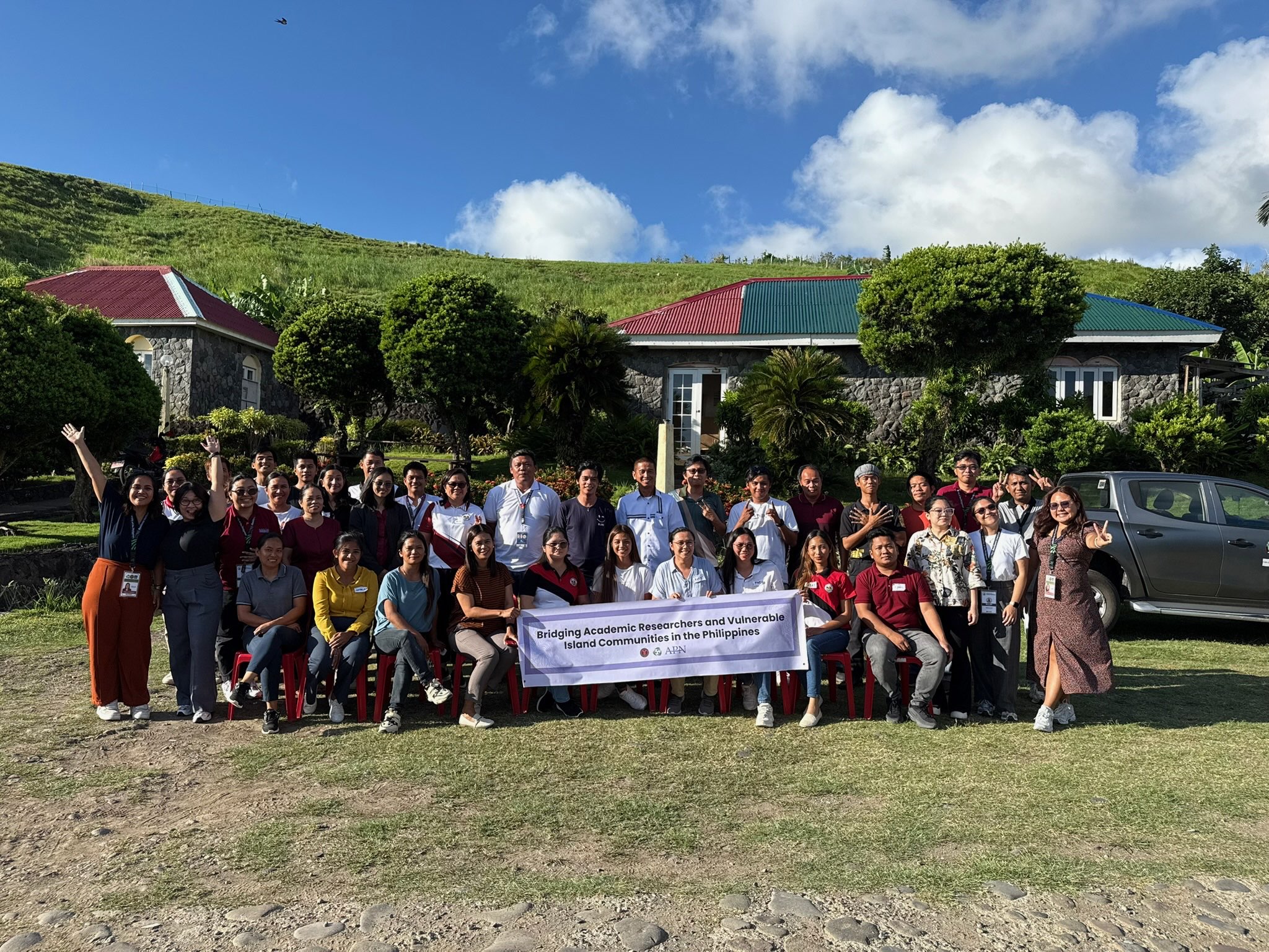
Batanes, Philippines — In a significant step toward strengthening climate resilience in one of the country’s most remote and vulnerable island provinces, the University of the Philippines Resilience Institute (UP RI) recently launched the Learn Phase of its project, Bridging Academic Researchers and Vulnerable Island Communities in the Philippines: Enhancing the Climate and Disaster Risk Management Capacities of Municipalities in Batanes, Philippines (APN–Batanes Project). The project kicked off with a hands-on Geographic Information System (GIS) training held on May 19–21, 2025, at the Batanes Resort in Basco.
The GIS training forms part of Phase 1: “Learn” under the three-phased capacity-building activities of the APN-Batanes Project
The GIS training forms part of Phase 1: Learn under the three-phase capacity-building activities of the APN–Batanes Project. This phase focused on introducing core concepts, principles, and tools for climate and disaster risk assessment, with a strong emphasis on applying GIS to support data-informed decision-making. GIS combines computer technology, spatial data, and mapping software to transform complex datasets into visual representations that help reveal patterns, relationships, and vulnerabilities in the landscape. These insights enable local leaders to better understand their environment, anticipate risks, and plan effectively for the future.
The workshop had four core objectives:
- To develop foundational and applied GIS skills for spatial analysis;
- To enhance participants’ abilities in collecting, processing, and managing spatial data;
- To support spatial analysis for identifying geographic patterns and vulnerabilities;
- To improve map-making skills that support evidence-based governance.
UP RI NOAH Center staff, along with representatives from the Local Government Units in Batanes and the Department of the Interior and Local Government – Batanes, participated in the workshop
Participants included representatives from the Provincial Government of Batanes, the Department of the Interior and Local Government – Batanes, and the local government units of Basco, Itbayat, Ivana, Mahatao, and Sabtang. Their active participation reflects a collective commitment to strengthening local institutions and anchoring adaptation efforts in both scientific knowledge and meaningful community engagement. Among the participating offices were the Planning and Development Office, Disaster Risk Reduction and Management Office, Municipal Engineering Office, Assessor’s Office, as well as sectoral offices such as Agriculture and Tourism.
Facilitated by the UP RI NOAH Center, the workshop began with foundational topics, including the history and applications of GIS, types of spatial data, map projections, and methods for spatial data collection and processing. These sessions progressed to more advanced techniques relevant to local governance, such as land use mapping and exposure unit analysis. In the final activity, participants created their own map layouts using key GIS elements, applying the techniques they had learned throughout the workshop.
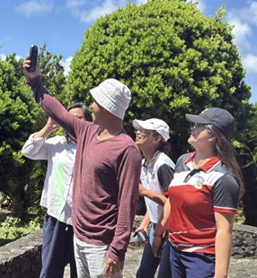 Dr. Rhodora Liceria H. Domingo, EnP. Isabella Victoria de Mata, Mr. Jay-Jay C. Blanquer, and Ms. Carol I. Naquita of the Municipality of Basco, Batanes, actively engaged in a field activity focused on geographic data collection and analysis.
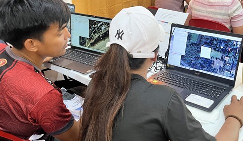
Mr. John Donovan Ydel and Ms. Rushell Meay Enego of the Municipal Disaster Risk Reduction and Management Office (MDRRMO) and the Municipal Planning and Development Office (MPDO) of Sabtang, Batanes, participate in hands-on GIS exercises as part of the training activity.
Data is the foundation of GIS, forming the backbone of all spatial analysis. It enables evidence-based decision-making grounded in actual and verifiable information. During the training, participants learned how to collect both primary and secondary data, such as using Global Navigation Satellite System (GNSS) devices and extracting features from Google Earth to identify key locations. They were also taught how to process and convert these datasets into usable formats in Quantum GIS (QGIS). The workshop introduced georeferencing techniques to integrate satellite imagery and digital maps into the software. These essential skills empower LGUs to collect their own data to support informed planning, analysis, and decision-making.
The succeeding session focused on land use mapping and the extraction of exposure units which are critical steps in preparing the LGU’s Comprehensive Land Use Plan (CLUP) and Climate and Disaster Risk Assessment (CDRA). The final activity provided participants with the opportunity to apply the skills and techniques they had learned by creating their own map layouts, ensuring the inclusion of all essential map elements. This hands-on exercise reinforced their understanding of GIS and demonstrated how spatial data can be transformed into useful tools for local planning and governance.
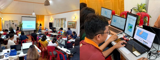 For. Janiella Sandoval guides participants through the essential elements of map design to support clear interpretation and presentation. Participants, including Ms. Kathleen Garcia (MDRRMO), Ms. Frea Mina (MPDO), and Mr. Ronald Cesar V. Castillejos (MAO), apply their skills by creating map layouts.
The local government units expressed enthusiasm for the presentations and activities, emphasizing the potential of GIS in enhancing key local plans such as the CLUP, CDRA, Local Climate Change Action Plan (LCCAP), Municipal Water Supply and Sanitation Master Plan (MWSSMP), and Disaster Risk Reduction and Management Plan (DRRMP). They highlighted its usefulness in monitoring zoning compliance, preparing and presenting data, supporting decision-making, and identifying effective strategies. Some also noted potential applications in cultural mapping for creative tourism circuits and heritage sites, plotting local road networks, tax mapping using cadastral data, and creating hazard maps.
This workshop marks a pivotal start to the project’s capacity-building journey, where traditional knowledge systems and scientific tools co-exist to strengthen Batanes’ resilience to increasing climate risks. By investing in the skills and knowledge of local actors, the project empowers communities not just to understand their vulnerabilities, but to act on them. As climate change continues to test the resilience of island communities, initiatives like this, grounded in inclusive learning and strategic collaboration represent a hopeful and sustainable path forward.