Posted by Cristan Malaiba of Hazard Assessment Team UPRI NOAH Center
Exploring the UP Resilience Institute NOAH Center’s Latest Simulation Efforts
The University of the Philippines Resilience Institute – NOAH Center is currently testing its ability to predict whether tsunamis generated by faraway earthquakes, sometimes thousands of kilometers away, will have devastating effects on the Philippines or pass by with minimal impact, shortly after a tsunami-forming earthquake occurs.
The latest simulation efforts focused on the recent magnitude 8.8 earthquake that struck the Kamchatka Peninsula in Russia, one of the ten largest earthquakes recorded globally since 1900.

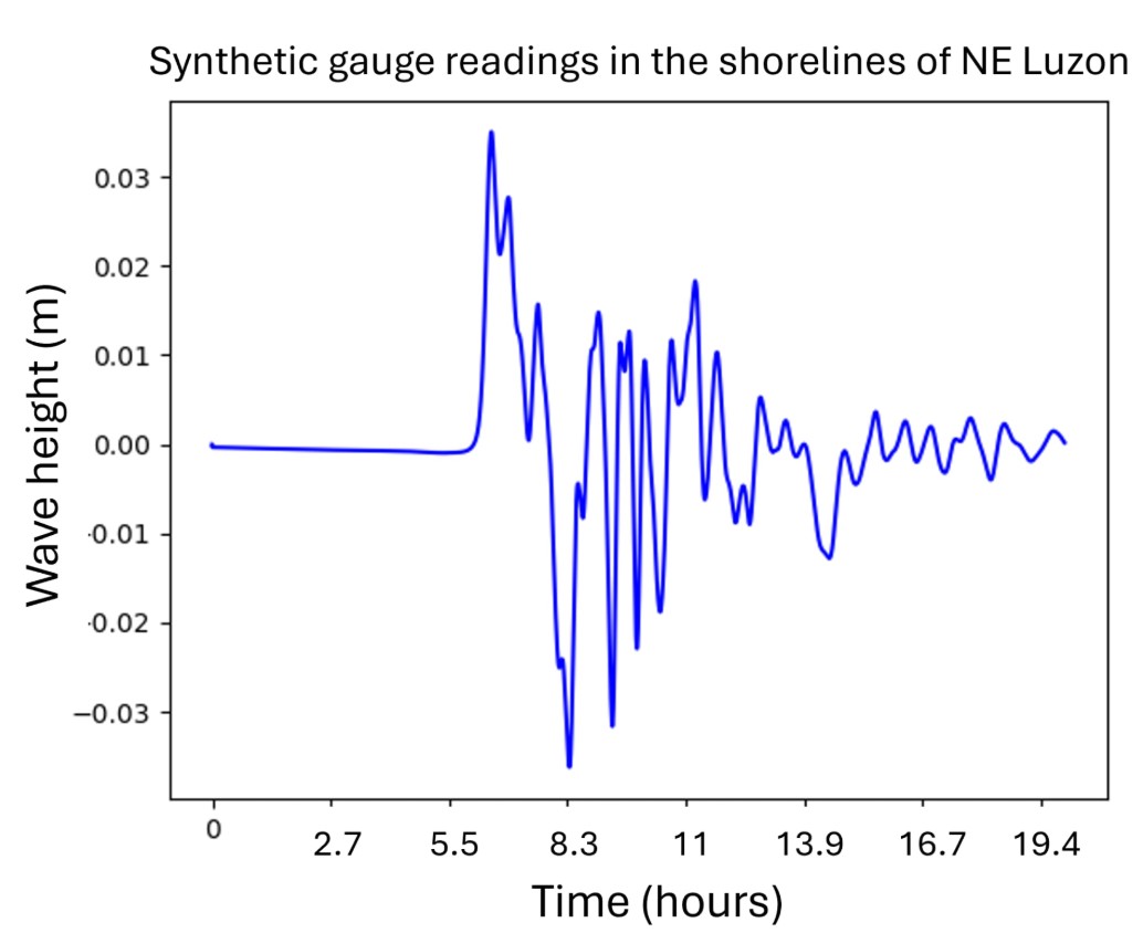
Initial results show that the Philippines is unaffected by this event. Tsunami waves expected to reach the country would be no more than 2 centimeters high. These waves would take approximately 7 hours to arrive, highlighting the critical window available for monitoring and issuing warnings when needed.
A key takeaway from this simulation is the importance of supplementing earthquake magnitude data with detailed fault line parameters. While magnitude tells us how strong the earthquake is, fault data will help us answer vital questions such as:
- Where will the major tsunami waves travel?
- How long will it take to arrive?
- Where will it be most destructive?
- How high will the waves be?
UPRI NOAH Center envisions this type of simulation being generated within minutes of an earthquake and quickly validated with surface data, enabling authorities to assess the threat and respond more effectively.
Simulation Technical Notes: This tsunami simulation was conducted using GeoClaw, part of the Clawpack suite, which solves the Shallow Water Equations to model wave propagation and coastal inundation. The Okada model was used to compute seafloor displacement resulting from fault movement. Simulation inputs included fault geometry, earthquake source parameters, and the best readily available bathymetry and topography data, all sourced from publicly available datasets.