


Hibok-Hibok
Hibok-Hibok Volcano, formerly known as Catarman Volcano, is located in the northwestern part of Camiguin Island, off the north-central coast of Mindanao. It is part of the Camiguin Volcanic Field within the North Mindanao Volcanic Region and represents the most recent phase of volcanism in the Central Mindanao Volcanic Arc. This volcanism is driven by the westward subduction of the Philippine Sea Plate beneath the Philippine Mobile Belt along the Philippine Trench.
Hibok-Hibok is the only active volcano among the island’s four overlapping stratovolcanoes. These are the Butay, Guinsiliban, Mambajao, and Hibok-Hibok. The volcanoes are aligned along a northwest-southeast trend and are generally arranged with the oldest at the southeast and the youngest at the northwest. Hibok-Hibok is the second highest volcano on the island next to Mambajao. It rises 1,290 meters above sea level, with its summit featuring three distinct peaks and a vegetated crater lake named Naujan. The stratovolcano is composed of pyroclastic deposits, lava flows, and domes, with its pyroclastic deposits composed of dacite and its lava flows consisting of hornblende andesite.
Hibok-Hibok comprises multiple lava domes, arranged from oldest to youngest based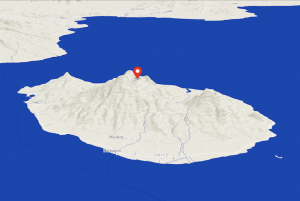 on lithostratigraphy: Old Mt. Catarman, Tres Marias, Carling, Tibane, Vulcan, and Hibok-Hibok domes. Among the three peaks at the summit, the Old Mt. Catarman Dome at the south is the highest and consists of blocky pyroxene and hornblende andesite. The highly eroded and vegetated Tres Marias Dome, located southeast of the volcano along the Mambajao-Itum Road, features three prominent peaks, from which it derives its name. The circular, flat-topped Carling Dome, situated on the north-northwest flank, is composed of dense hornblende andesite. The Tibane Dome, located on the northwestern flank, consists of dense hornblende andesite, with a basal lava flow representing an early effusive stage and pyroclastic debris at the summit, which indicates a late explosive phase. Vulcan is a prominent hill on the lower west-northwest flank near the coast composed of coarse- to medium-grained hornblende andesite. Hibok-Hibok, consists of massive lava intercalated with volcanic breccia, debris flows, and tuffaceous beds and are andesitic in composition.
The most recent eruptions of Hibok-Hibok Volcano formed the Vulcan and Hibok-Hibok domes. The Vulcan Dome, erupted from 1871 to 1875. During the waning phase of its eruption, thick lava flows poured into the sea. The eruption resulted in approximately 1 square kilometer of subsidence in its northwest portion due to magma withdrawal. The volcano remained quiet until 1897 and 1902 when solfataric activity emerged at the summit crater northeast of the Old Mt. Catarman Dome. Solfataric activity persists until today, but no significant eruptions have occurred in subsequent decades.
In the last week of August 1948, a series of earthquake swarms signified renewed volcanic unrest at Hibok-Hibok. This culminated in an explosive eruption on September 1, 1948 within the summit crater, followed by minor eruptions until 1950. The initial eruption produced a cauliflower-type ash column, accompanied by nuées ardentes, the french term for incandescent pyroclastic density currents. Lava flows later followed descending along the northeast flanks of the volcano. The blocky, massive to jointed Kanangkaan lava flow was extruded from a northeast-trending lateral fissure below the crater rim, continuing into 1949. Lahars were common in the island after this eruptive period.
In May 1949, the Hibok-Hibok Dome began forming at the site of the solfataras. From June 1949 to September 1950, the Itum lava flow, a smaller gray-black, vesicular to massive flow, formed south of the Kanangkaan flow. On September 15, 1950, another explosive eruption, similar to that of September 1, 1948, devastated the northern slope of the volcano. This event was accompanied by nuées ardentes and the formation of Ilihan lava flow, which persisted until 1951. By late 1951, the Hibok-Hibok Dome had nearly filled the entire summit crater, eventually overflowing onto the northeast slope before collapsing into a large avalanche in May 1953. The last recorded eruption of Hibok-Hibok Volcano occurred on July 14, 1953, producing small ash emissions.
Local folklore attributes the 1871 eruption of the Vulcan Dome to divine intervention. According to oral tradition, the event was a response to the moral decline of the community, with the eruption serving as divine retribution. This catastrophic eruption destroyed Cotta Bato, a 19th century town on Camiguin Island, including the San Roque Church. The remnants of the church, convent, and bell tower still stand as historical landmarks. Land subsidence along the coastline also resulted in sinking of a cemetery, now known as the Sunken Cemetery. A large white cross, erected in 1982, commemorates this site and serves as a historical landmark.
The 1951 Hibok-Hibok eruption, which claimed hundreds of lives and thousands of livestock, is similarly regarded by island elders as a manifestation of divine displeasure. According to local belief, younger Camiguenos who neglected religious practices–such as attending mass, observing feast days, and making the sign of the cross–provoked the eruption. When children misbehave, elders still glance fearfully at the volcano and mutter, “The volcano will get angry.” This devastation led to a mass evacuation, reducing the island’s population from 69,000 to 34,000. At present, the Vulcan Dome is a popular pilgrimage site for Catholics during the annual Panaad sa Camiguin on Holy Week. The walkway to the hill’s summit is lined with 14 Stations of the Cross, featuring life-sized statues depicting the Passion of Christ.
Hibok-Hibok, along with Timpoong, which is the lava dome at the peak of Mambajao, were formally designated as the Philippines’ 8 th ASEAN Heritage Park in 2015. The Timpoong-Hibok-Hibok Natural Monument encompasses the last remaining rainforest on Camiguin Island, providing critical habitat for a diverse array of endemic flora and fauna. The protected area stretches 2,227.62 hectares, comprising 300 hectares of mossy forests above 1,100 meters in elevation, 1,282 hectares of residual lowland dipterocarp forests above 500 meters, and 1,585 hectares of open grasslands. Among its endemic plant species are Miguelia reticulata, Medinilla multiflora, Memecylon subcaudatum, Syzygium camiguense, Coelogyne confusa and Goodyera ramosii. Its endemic fauna include the Camiguin hanging parrot (Loriculus camiguinensis), the Camiguin forest mouse (Apomys camiguinensis), and the Camiguin forest rat (Bullimus gamay).
The natural monument is also known for its unique hydrological features, which serve as major tourist attractions. As a geothermal site, it hosts both hot and cold springs, including the Ardent and Santo Niño Springs. Its steep and rugged terrain gives rise to several waterfalls, such as the Katibawasan, Binangawan, and Tuasan Falls, as well as key river systems like the Sagay and Binangawan Rivers.
Other Names: Mt. Catarman
Latitude and Longitude: 9.20415 124.67120
Region: Region 10
Tectonic Setting: Subduction (Molucca Sea Plate)
Volcanic Arc/Belt: Central Mindanao Volcanic Arc (CMVA)
Volcanic Region/Field: Camiguin Volcanic Field, North Mindanao Volcanic Region
Volcano Type: Stratovolcano
Last Known Eruption: 1953
Morphometry Type: Small Steep Cone
Highest Peak (masl): 1330
Coordinates of Highest Peak: 9.20338 124.67659
Prominence (m): –
Basal Area (km2): 23.9
Basal Width (km): 5.8
Volume (km3): 6.3
How to cite this page:
UPRI (2025). Hibok-Hibok: Volcanoes of the Philippines (NOAH Open File Reports). Distributed by the University of the Philippines Resilience Institute, compiled by Paula Jatulan. ISSN 2362 7409.
References:
Corpuz, E. S. G. (1992). Petrology and geochemistry of the central Mindanao volcanic arc, southern Philippines. https://ir.canterbury.ac.nz/handle/10092/5789
Dvorak, J. (2017, February 6). Volcano Myths and Rituals. American Scientist. https://www.americanscientist.org/article/volcano-myths-and-rituals
Hibokhibok Natural Monument. (n.d.). 7641 Islands of the Philippines. Retrieved February 25, 2025, from https://7641islands.ph/explore/visiting-mounts-timpoong-hibokhibok-natural-monument/
Jerusalem, J., & Abaño, R. J. (n.d.). Camiguin’s Timpoong, Hibok-Hibok declared Asean Heritage Park | Inquirer News. Retrieved February 25, 2025, from https://newsinfo.inquirer.net/774287/camiguins-timpoong-hibok-hibok-declared-aseanheritage-park
Earthquake- & Volcano-Related Maps | GeoHazards Portal | PHIVOLCS | DOST. (n.d.). https://gisweb.phivolcs.dost.gov.ph/gisweb/earthquake-volcano-related-hazard-gis-information#
Global Volcanism Program | Camiguin. (2024). Smithsonian Institution | Global Volcanism Program. https://volcano.si.edu/volcano.cfm?vn=271080
Macdonald, G. A., & Alcaraz, A. (1956). Nuées ardentes of the 1948–1953 eruption of Hibok-Hibok. Bulletin of Volcanology, 18(1), 169–178. https://doi.org/10.1007/bf02596620
Maso M. S. (1904). Report on the Seismic and Volcanic Centers of the Philippine Archipelago. Manila: Bureau of Public Printing.
Paguican, E.M., Grosse, P., Fabbro, G.N., Kervyn, M. (2021) – Morphometric classification and spatial distribution of Philippine volcanoes. https://doi.org/10.1016/j.jvolgeores.2021.107251
THE RUINS OF SAN ROQUE CHURCH. (n.d.). Visit Region 10. Retrieved February 25, 2025, from https://www.visitregion10.com/camiguin-seeanddo/the-ruins-of-san-roque-church
TIME. (1951, December 17). THE PHILIPPINES: Tragedy at Hibok-Hibok. TIME. https://time.com/archive/6796911/the-philippines-tragedy-at-hibok-hibok/ Visiting Mounts Timpoong
PHIVOLCS-LAVA Eruption History. https://wovodat.phivolcs.dost.gov.ph/volcano/erupt-history