Assistance during Disasters (Public Service) – Usman Landslide (Technical Assistance)
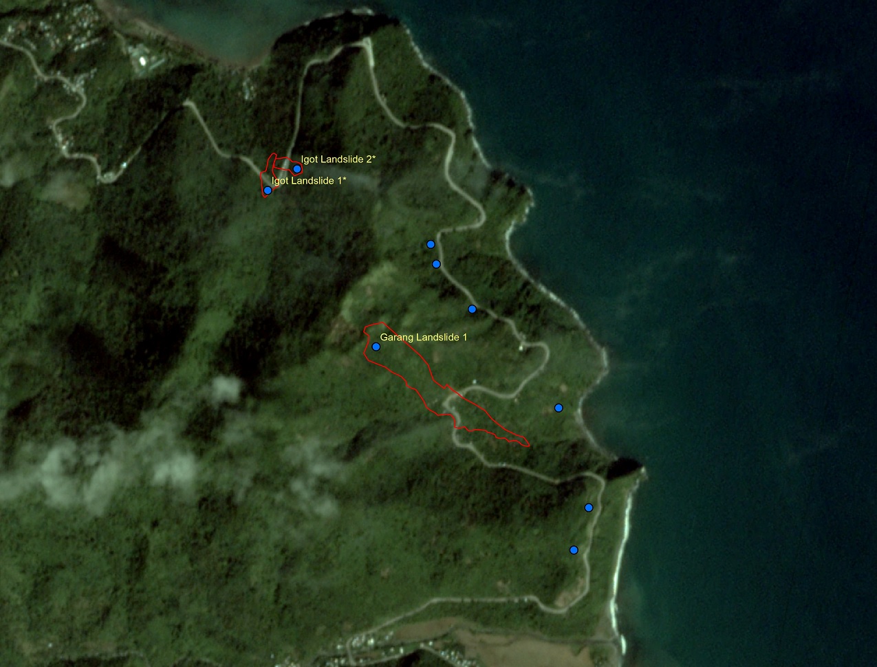
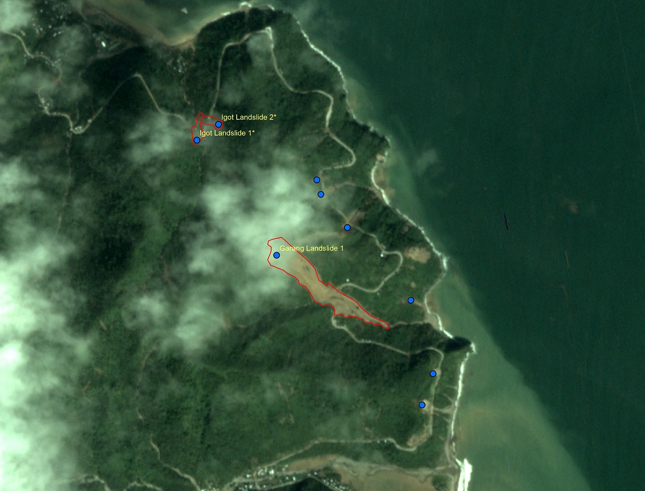
Outlines of landslide events during Typhoon Usman were identified. Pre- and post-disaster images of Barangay Patintinan, Sagnay, Camarines Sur. Outlines in the post-disaster imagery are the landslides triggered by torrential rains of Typhoon Usman.
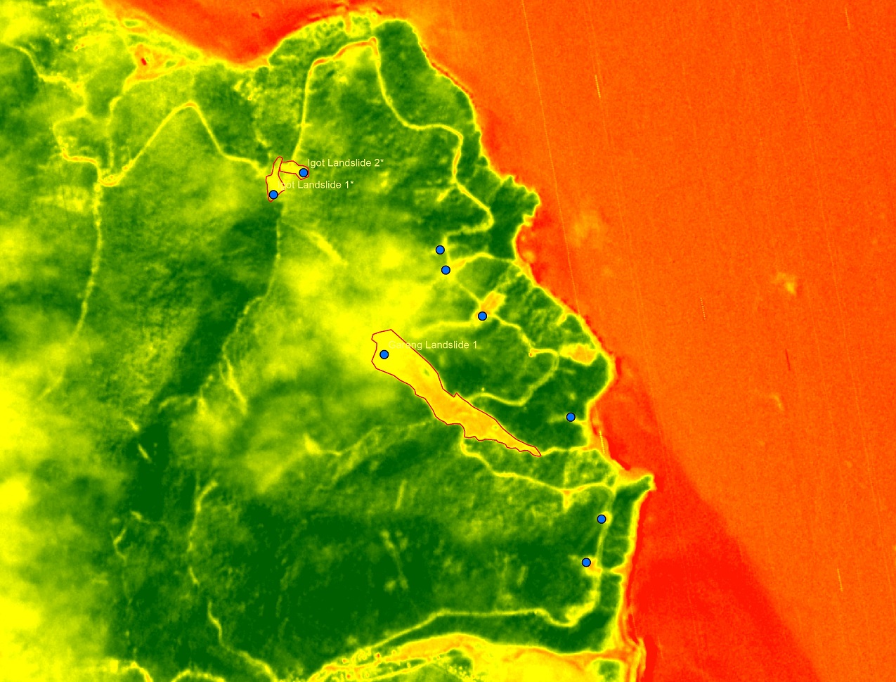
Post Typhoon Usman Normalized Difference Vegetation Index (NDVI) satellite imagery to delineate landslide boundary.
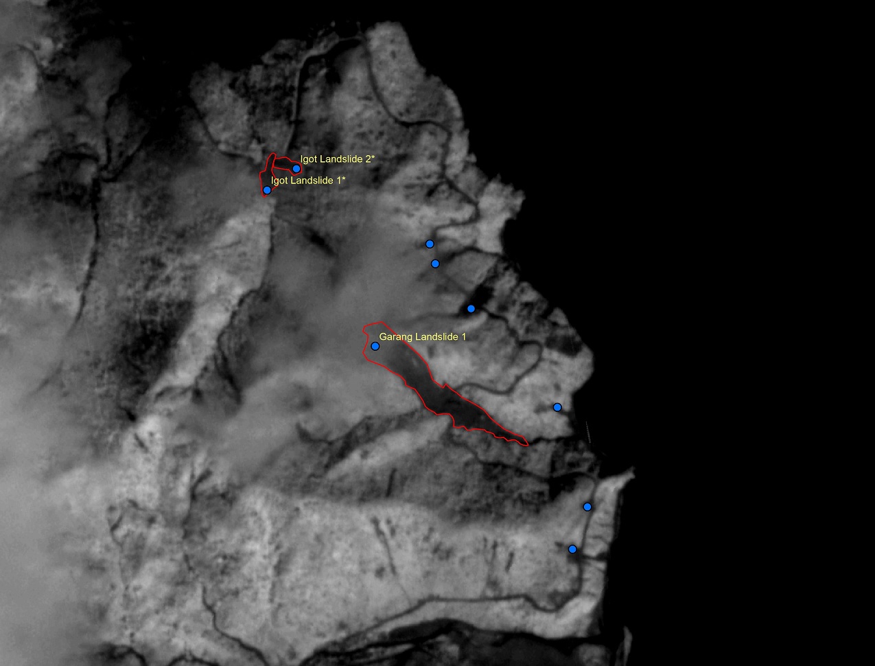
Post Typhoon Usman Near Infrared (NIR) satellite imagery to delineate landslide areas that are covered by cloud.
Source: PlanetScope, UPRI, NOAH. Processing and analysis of satellite imagery by CM Escape with inputs from the NOAH Team, Zhander Cayabyab of ABSCBN, Datos Team and FB netizens.