By: Janiella Sandoval
The Municipality of Balaoan, in partnership with the University of the Philippines (UP) Resilience Institute (RI), held its second workshop focused on strengthening local planning and disaster resilience. Building on the outcomes of the first workshop, which established the Technical Working Group (TWG) and identified stakeholders for updating the municipality’s development plans, this session was dedicated to refining Balaoan’s vision statement to better reflect the community’s evolving aspirations. This effort plays a pivotal role in developing the Comprehensive Land and Water Use Plan (CLWUP) by addressing the municipality’s key needs, challenges, and opportunities.
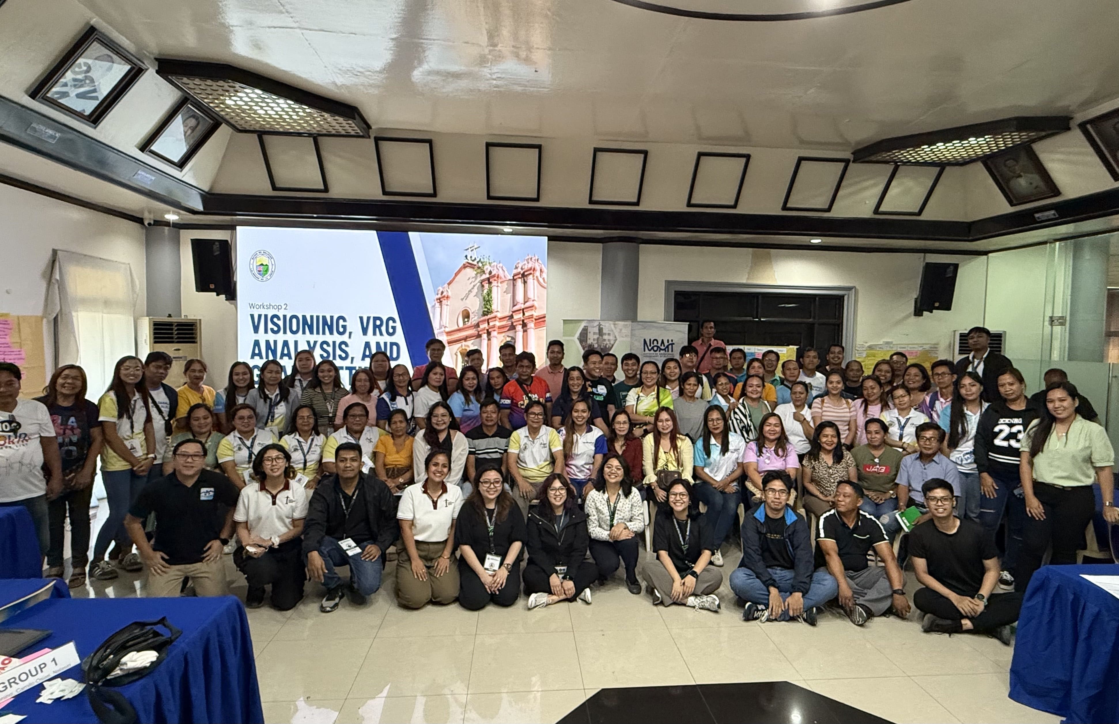
UP RI NOAH Center staff, along with representatives and stakeholders from Balaoan.
The workshop took place on March 12–13, 2025 at the Municipality of Balaoan, bringing together municipal personnel, barangay officials, technical experts, and local stakeholders. Researchers from UP RI NOAH’s Planning Component opened the session by presenting the data gathering results for the Ecological Profile (EP), which covered the five development sectors: environmental, social, infrastructure, economic, and institutional. The EP provided a thorough assessment of the municipality’s resources, service levels, and policies, documenting Balaoan’s current state. It also facilitated a situational analysis that identified key concerns impacting both the natural and human systems.
Atty. Mark Gamboa, a lawyer, licensed environmental planner, and assistant professor at the UP School of Urban and Regional Planning (SURP), led the session on vision setting. The vision statement served as a shared, forward-looking perspective for Balaoan’s sustainable development. During the breakout session, participants were divided into sectoral groups, where they worked on crafting a long-term development vision for the municipality. They also developed outward- and inward-looking descriptors and indicators. The outward-looking component represented the municipality’s desired role at the national level, while the inward-looking component defined the ideal local environment for residents to live and sustain their livelihoods.
Assistant Professor Charlie E. Cabotaje, a licensed environmental planner and faculty member at the UP National College of Public Administration and Governance ( NCPAG), then guided participants through a Strengths, Weaknesses, Opportunities, and Challenges (SWOC) Analysis. This structured method enabled participants to examine internal and external factors shaping municipal development. They identified strengths to build on, weaknesses to address, opportunities to seize, and challenges to overcome, setting the stage for data-driven and future-oriented strategies in land and water use planning.
Building upon the vision-setting discussions, Atty. Gamboa facilitated a deep dive into vision-reality gaps and goal setting. Participants revisited their vision and identified gaps between their aspirations and the municipality’s current state. They analyzed observed conditions, causes, implications, spatial locations, and policy options. During the goal-setting phase, participants defined clear objectives, targets, and strategies to achieve the municipality’s development priorities, ensuring their plans were vision-driven, evidence-based, and community-centered.
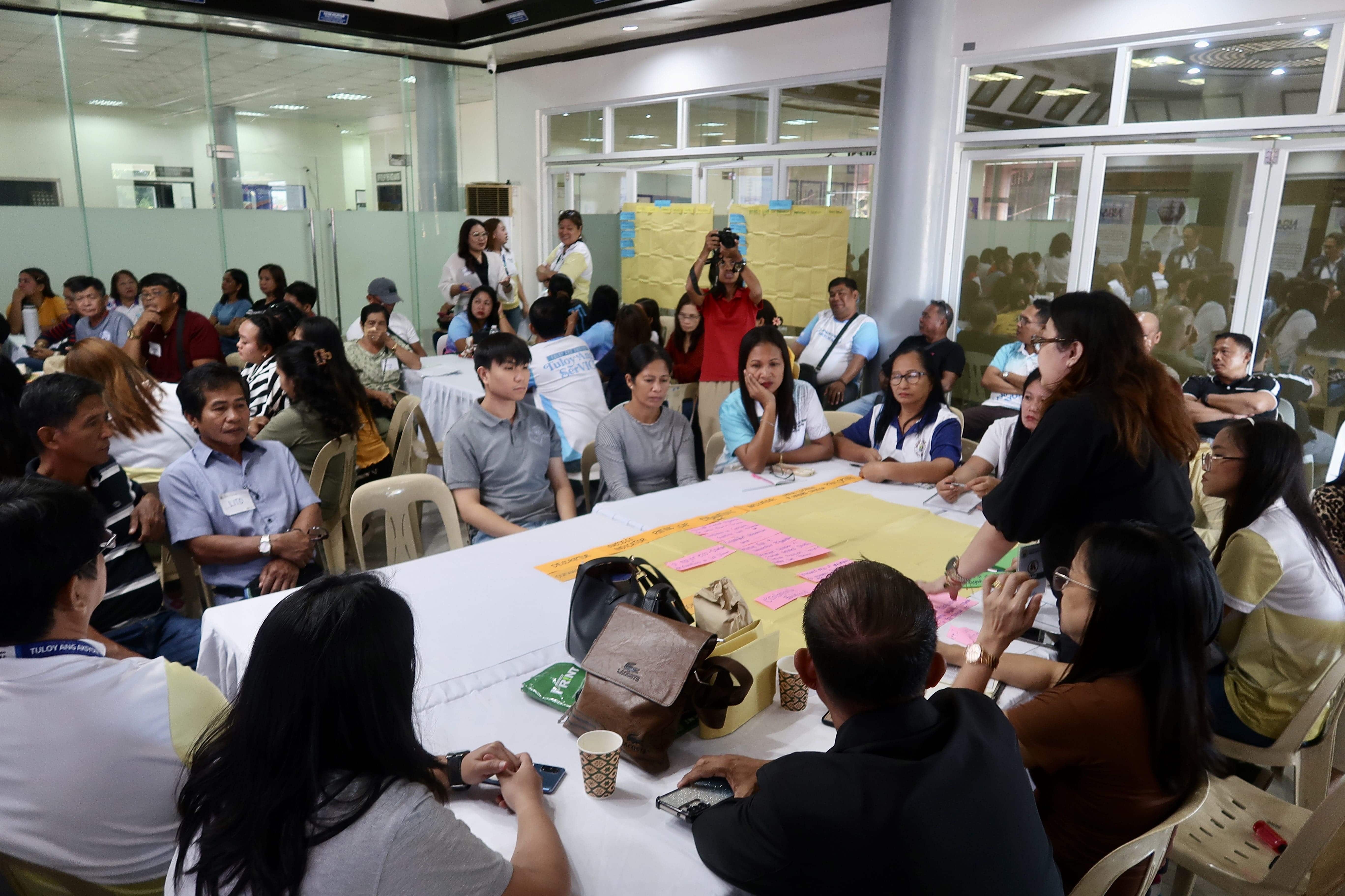
UP RI staff discuss and participants the Municipality’s vision and reality gaps.
Next, Mr. Julius Obrique, Senior Project Officer and GIS Specialist from UP RI NOAH Planning Component, presented the existing land and water use framework. With support from the Office of the Municipal Assessor and barangay representatives, the team finalized administrative boundaries, integrated sectoral spatial data, conducted participatory mapping of land and water uses, and developed an exposure database.
The workshop concluded with a presentation on geologic and hydrometeorologic hazards by UP RI NOAH researchers. Mr. Dino Evangelista from the Flood Modeling Component, along with Ms. Lea Serrano and Mr. Cristan Malaiba from the Hazards Assessment Team, analyzed Balaoan’s exposure to various risks, including earthquake-related hazards, volcanic activity, land subsidence, rain-induced landslides, severe winds, storm surges, and flooding.
By refining its long-term vision and integrating risk-informed strategies, Balaoan is taking proactive steps toward sustainable development and disaster resilience. The workshop enabled meaningful collaboration among stakeholders, ensuring that planning efforts are inclusive and data-driven. These initiatives will help guide Balaoan toward becoming a resilient, adaptive, and future-ready community.