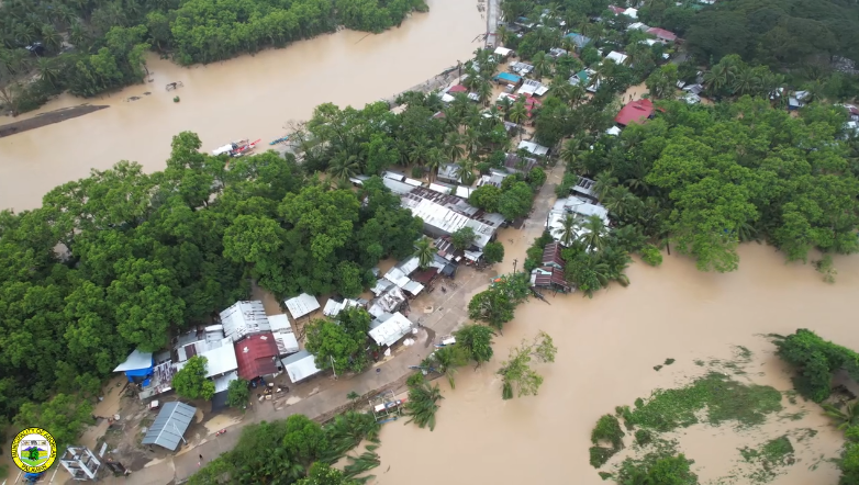
The University of the Philippines (UP) Resilience Institute (UP RI) – Nationwide Operational Assessment of Hazards (NOAH) Center had the opportunity to validate their current flood hazard map of Palawan during the recent flood event that occurred in the province. The Municipality of Aborlan and the City of Puerto Princesa experienced a rare occurrence of extreme flooding on Sunday, February 9, 2025. According to the Philippine Atmospheric, Geophysical, and Astronomical Services Administration (PAGASA), the formation of a shear line brought over 340 mm of rain that relentlessly poured between the hours of 8 and 11 in the morning. As defined by PAGASA, a shear line occurs when the Northeast Monsoon or ‘Amihan’ converges with the warm winds of the Easterlies coming from the Pacific Ocean.
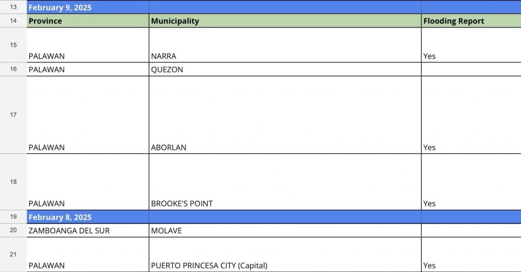
Flooding occurrence in different areas of Palawan was predicted a day in advance by the Impact Based Flood Forecasting System of UP NOAH. The Rain Forecast data was available on the NOAH website’s Exposure Assessment section. More information about the article ‘An Impact Based Flood Forecasting System for Citizen Empowerment’ can be read here: https://serp-p.pids.gov.ph/publication/public/view?slug=an-impact-based-flood-forecasting-system-for-citizen-empowerment.
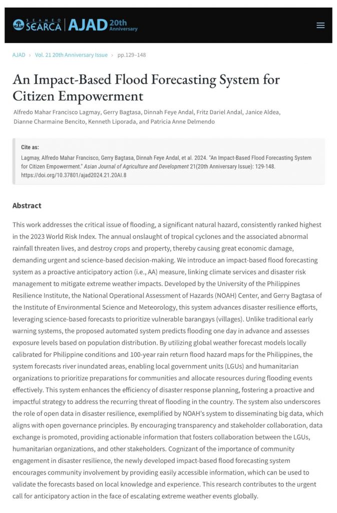
Different levels of flooding were also experienced in several parts of the MIMAROPA Region, especially in low-lying areas. According to reports, some cities and municipalities in Oriental Mindoro (Baco, Calapan City, Naujan, Socorro, and Victoria) were affected, as was the Municipality of Narra in Palawan. The flooding incidents have triggered evacuation efforts by the local government, particularly in low-lying areas and near water bodies or natural waterways.
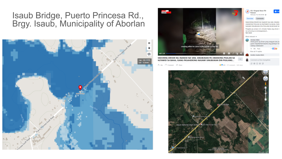
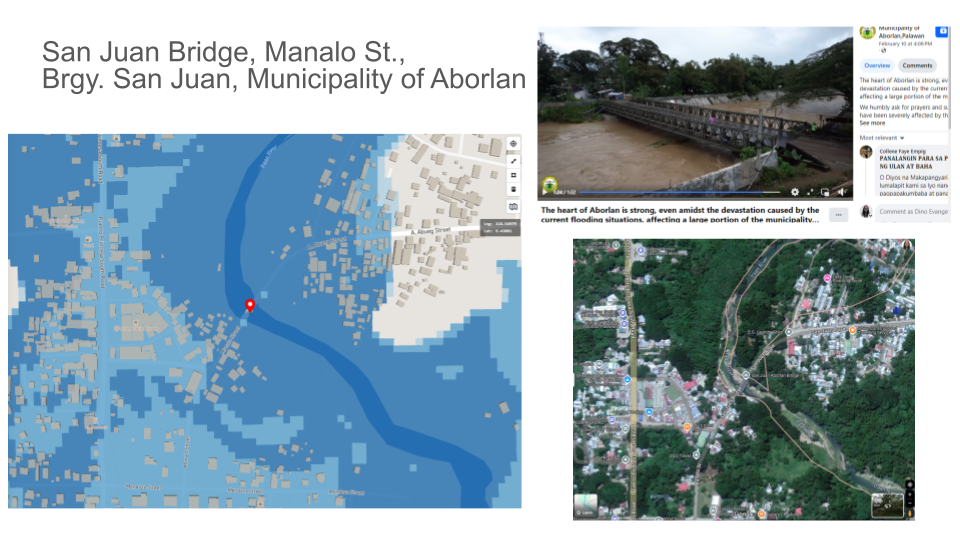
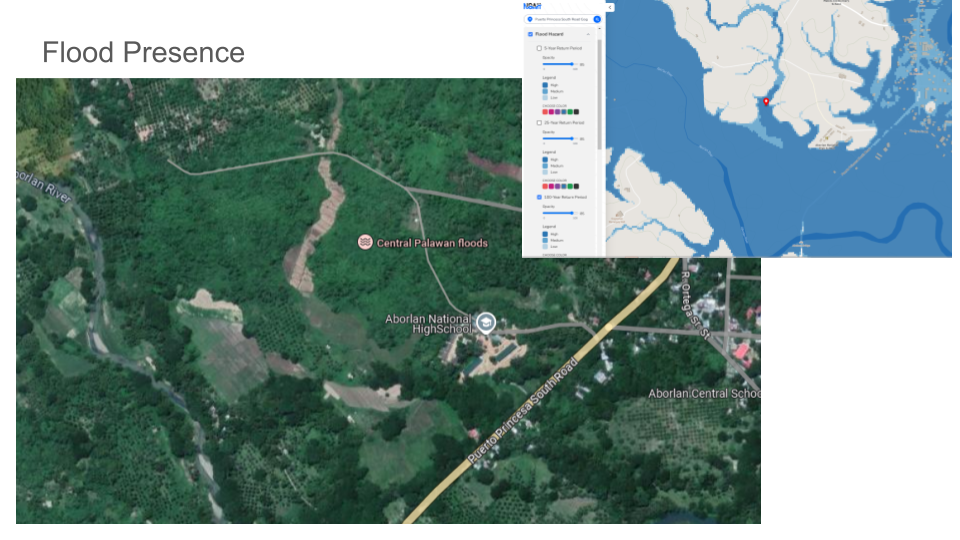
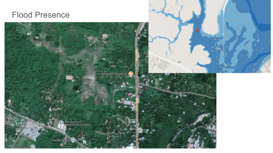
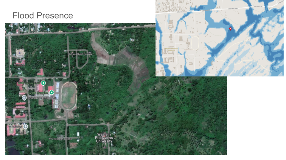
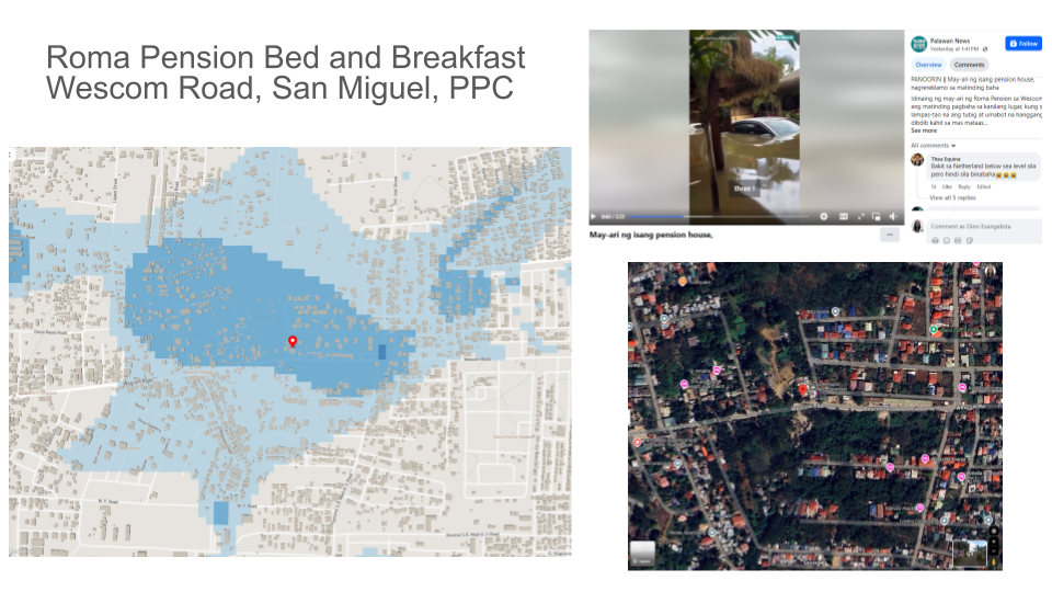
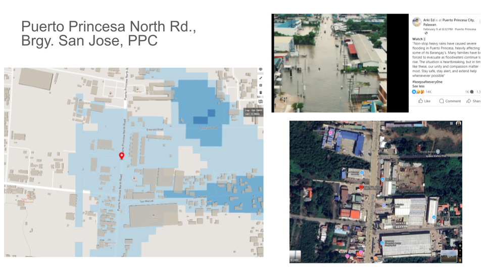
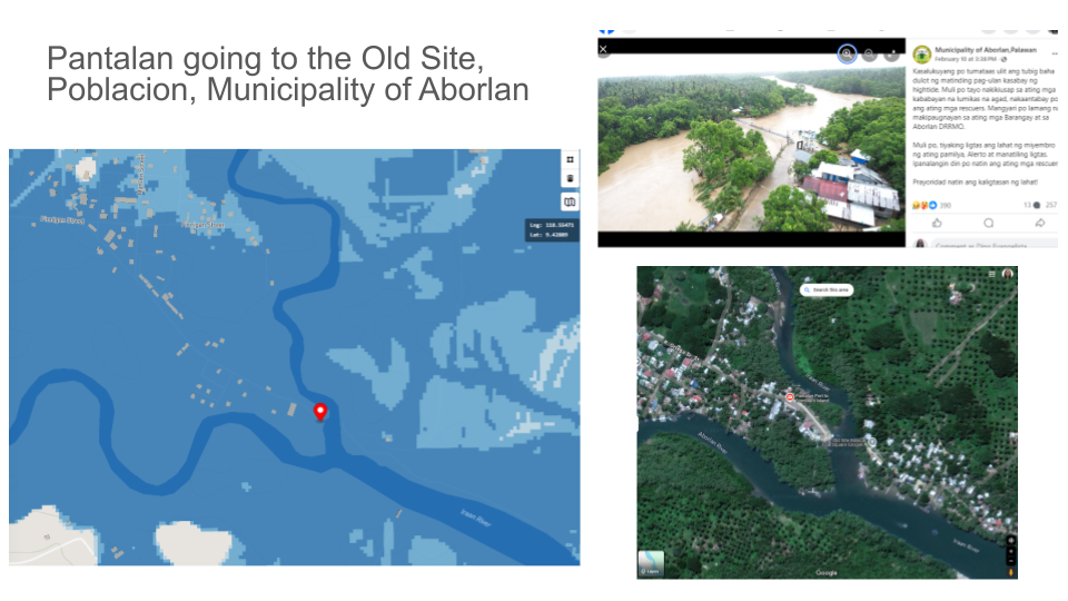
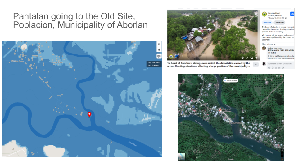
This validation drew information from Facebook (FB) posts made about the flooding. NOAH researchers also utilized Google Earth to further confirm the location, terrain, and other useful characteristics of the area. The flood hazard maps on the NOAH website were able to specifically reflect the presence of flooding in several affected areas. These areas include the Isaub Bridge, Pantalan area, and San Juan Bridge in Aborlan, and Roma Pension Bed and Breakfast and Puerto Princesa North Rd. in Puerto Princesa City.
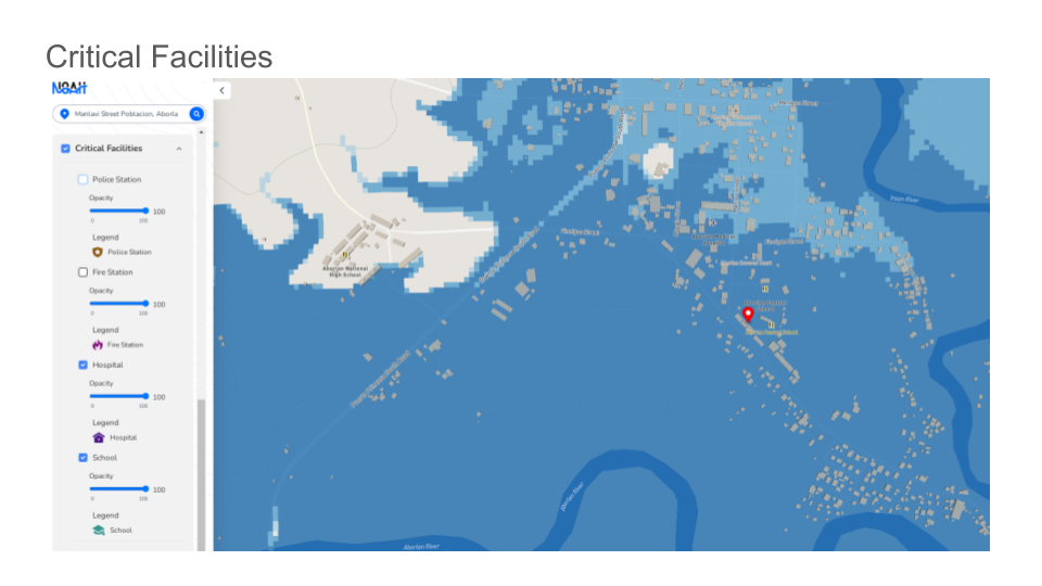
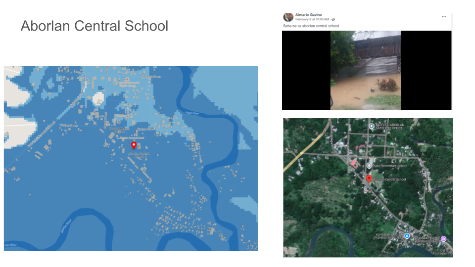
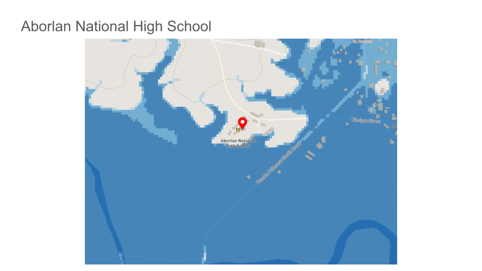
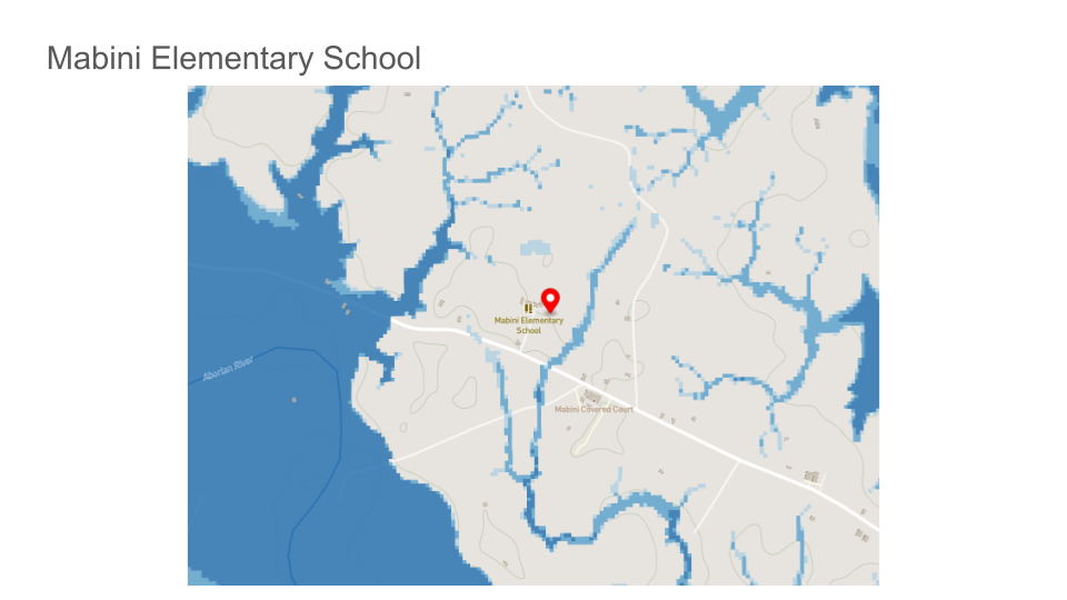
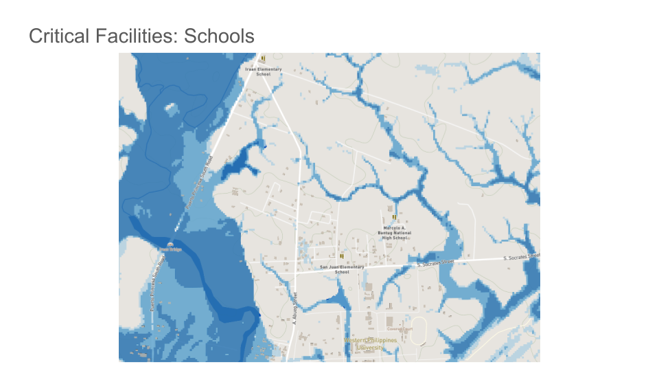
The NOAH website was also utilized to check critical facilities that are affected by flooding. In the case of Aborlan, several public schools and a hospital was identified. One FB post validated the exact location of the flood and its presence in Aborlan Central School. Aborlan National High School and Mabini Elementary School were deemed safe along with the Western Philippine University (WPU), San Juan Elementary School, M.A. Bantug National High School, and Iraan Elementary School in the northern part of Aborlan.
A comparison of satellite imagery and flood hazard maps on the NOAH website revealed interesting information about the affected areas. Areas that seem to be dried-up creeks or natural waterways showed evidence of human activities. Because water naturally follows this path as it goes downstream, it may be expected that surface water will be present in these areas when it rains. During extreme events, deeper inundation and possibly even strong currents may occur, which may possibly destroy built structures.