The Philippines has always experienced a significant number of tropical storms, typhoons, and Low-Pressure Area (LPA)-enhanced monsoons due to its location within the Pacific Typhoon Belt. These rainfall events, whether they be extreme or short-lived, can lead to flooding. The costly effects of floods have been among the main concerns of the country in recent years.
Flooding concerns have been present since the pre-Hispanic times, especially in settlements built near bodies of water. At present, floods are aggravated by uncontrolled urbanization and cause even bigger environmental and social problems. Despite various efforts taken by the government and other concerned entities, flooding continues to persist. Its effects are further exacerbated by continuous population increase and climate change.
In 2012, as part of the of the national government’s pursuit of appropriate and effective climate actions, Project Nationwide Operational Assessment of Hazards (NOAH) started mapping out the natural hazards in the country. After its institutionalization in 2016, the UP RI – NOAH Center continued to advance climate and disaster resilience through Science-based processes such as hazard simulations. The UP NOAH website was also launched, providing access to the hazard data generated by the institute.
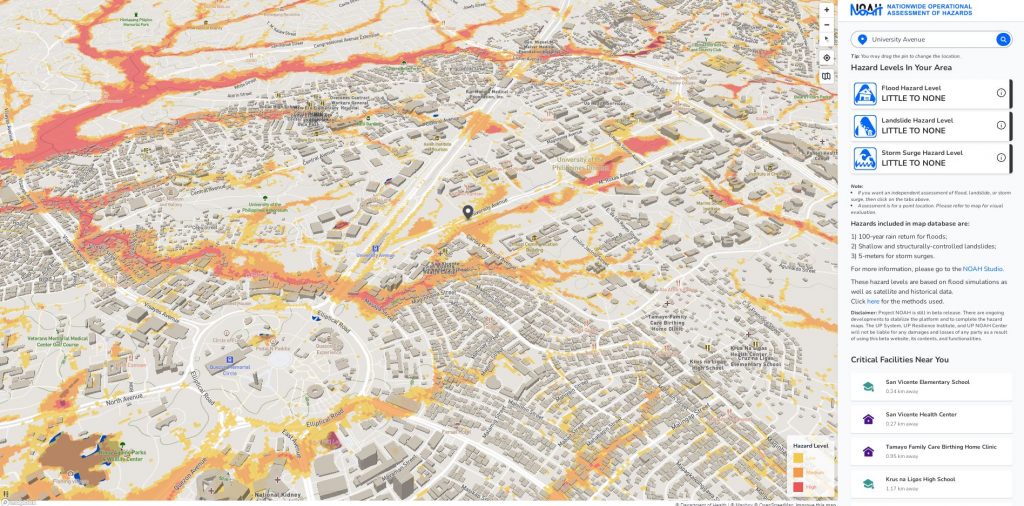
The flood maps are validated through satellite data, anecdotal evidence from local residents, interviews with local government officials, and on-site observations. Key informant interviews supplement quantitative flood data with information on social and environmental conditions, as well local government initiatives.
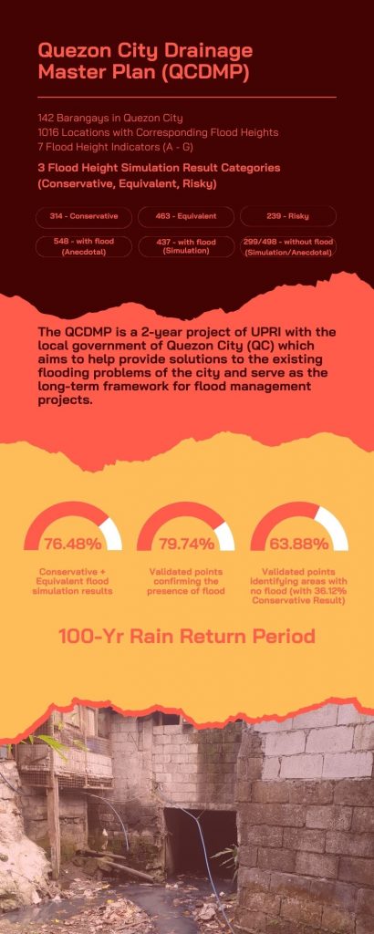
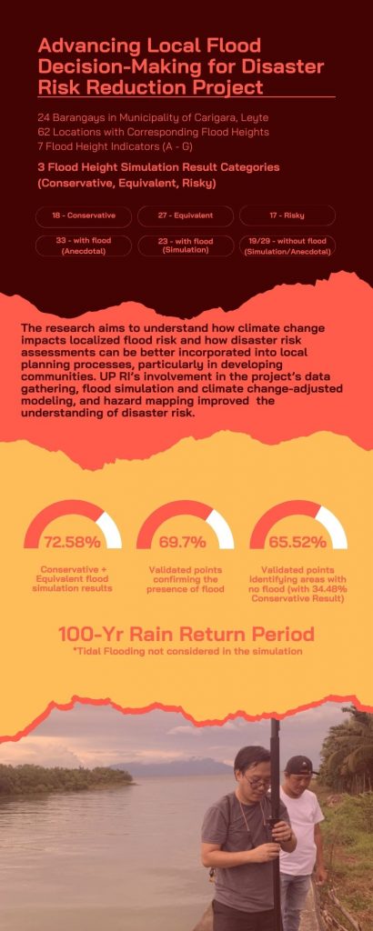
In 2022, as part of the Quezon City Drainage Master Plan project, UP NOAH validated their Quezon City flood hazard map through a series of surveys, interviews, and field activities. The accuracy of the map was evaluated through a matrix that showed how the heights provided by the simulations compared against anecdotal flood heights. This method was also used in 2023 to validate the high-resolution maps that were created for the Municipality of Carigara as part of a project called “Advancing local flood decision-making for disaster risk reduction”.
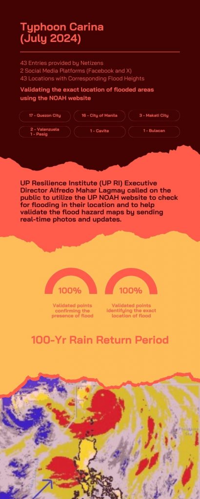
In July 2024, during Typhoon Carina, a slightly different approach was used to check model accuracy. Data crowd-sourced from Facebook and X were compared to the existing flood maps. A total of forty-three photos and videos were used to identify flooded areas to validate the presence of flooding.
What to expect in 2025?
UP RI – NOAH Center will continue to provide vital information on disaster and climate risks. Flood simulations are still ongoing and new models are continually being made. The results from ongoing models will be made available in the NOAH website: https://noah.up.edu.ph/.