On November 22, 2025, the UP Resilience Institute YouthMappers (UPRIYM) conducted a one-day workshop introducing its members and applicants to the role of drones in geospatial data acquisition and community mapping for resilience. Drone-captured imagery has become increasingly valuable to UPRIYM’s work, especially in supporting OpenStreetMap (OSM) through improved, high-resolution data that enhances the accuracy of maps used for resilience initiatives. Facilitated by Ms. Monica May Mendoza of the UPRI Education Division, the activity brought together four UPRIYM members and three applicants. The session aimed to build participants’ familiarity with how drones support mapping by capturing up-to-date aerial imagery to strengthen community-based initiatives that rely on detailed and openly accessible geographic information.
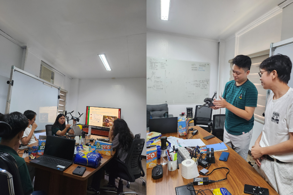
The morning session, held at the UPRI Conference Room, introduced participants to the basics of drones and their role in OpenStreetMap. Through the discussion, the importance of how drone imagery can fill gaps in mapping, especially in areas where satellite data may be outdated, low-resolution, or unavailable, was emphasized. A brief drone demonstration followed, highlighting its parts, basic controls, handling, and essential do’s and don’ts for safe operation. This provided participants with a necessary foundation before proceeding to field practice.
In the afternoon, the workshop moved outdoors to the College of Mass Communication (CMC) Hills, where the workshop’s practical component was held. Primarily, cones were positioned as guide markers to assist the participants in practicing controlled maneuvering techniques. Afterwards, each participant was given the opportunity to operate a drone, practice hovering around the cones, make directional adjustments, and try the standard square-pattern flight. For first-time pilots, this hands-on experience demonstrated the precision, spatial awareness, and discipline required in actual drone operations.
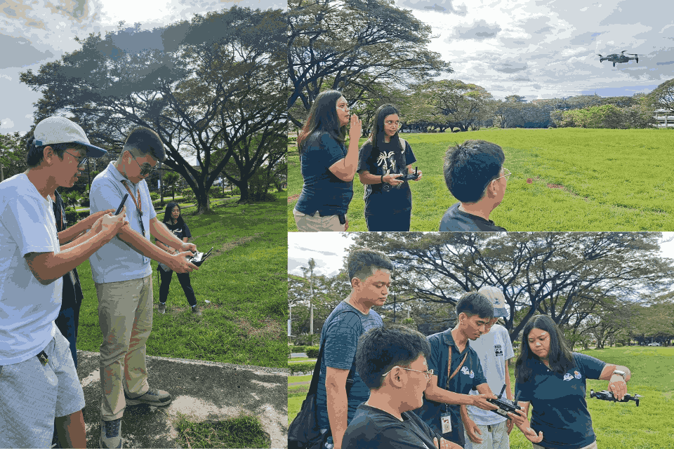
“We had an incredible experience. This was our first time piloting a drone within professional standards. We all got to try out navigating the field, practicing the right commands in every turn, and we even took pictures together from the sky! Caution was also exercised as we were able to apply various pre-flight procedures and proper handling of the drone, making our experience much more realistic,” shared Miggy Nava Teran, one of the participants. This reflection highlighted how the workshop not only taught technical skills but also made drone piloting engaging, memorable, and grounded in real-world practice.
Beyond the hands-on experience, the workshop reinforced UPRIYM’s commitment to advancing open geospatial data for the public good. As drone imagery continues to enrich the detail and accuracy of OSM, youth mappers gain a stronger platform for supporting community mapping efforts across the country.
Looking ahead, UPRIYM plans to conduct similar workshops to accommodate members and applicants who were unable to attend. The organization remains committed to strengthening its capacity-building programs, enabling students to apply science-based geospatial approaches in support of community resilience initiatives.