
Written by: Marc Forneste and Audrei Anne Ybanez of NOAH Hazard Assessment Team
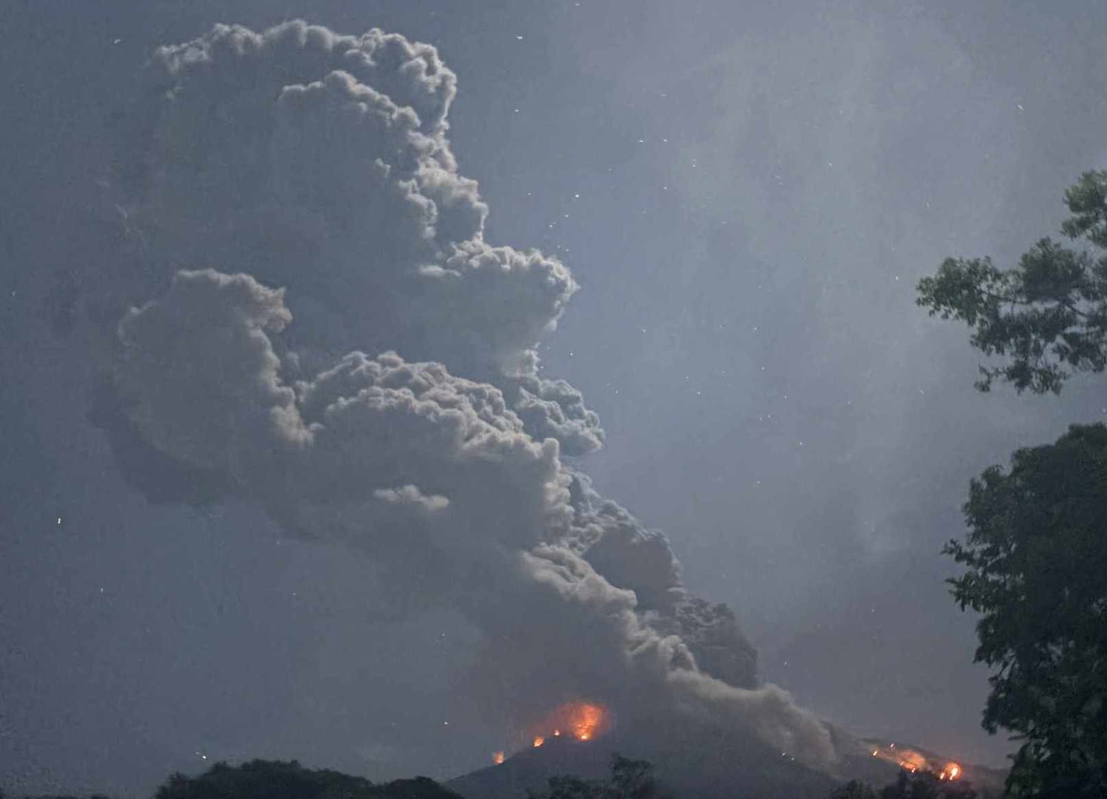
Exactly one week after the February 19 event, Mount Kanlaon erupted again on February 26, 2026. According to data from PHIVOLCS and the Tokyo VAAC, the eruption began at approximately 7:04 PM (local time) and lasted for about two minutes. The event produced an ash plume rising to roughly 5 kilometers above sea level and was followed by an ash emission episode that persisted for about 71 minutes.
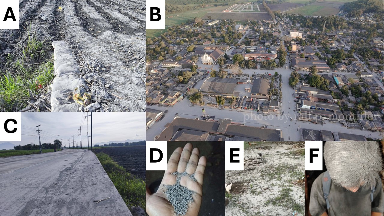
The ash plume once again drifted toward the southwest, influenced by strong winds of around 12 m/s at elevations of 4–5 kilometers. As a result, ash was dispersed across a wide area of the Negros Island Region, with the heaviest ashfall reported in La Castellana and Pontevedra, Negros Occidental. Observers also documented sulfurous fumes and shockwaves associated with the eruption. Reports from regional, provincial, and local authorities indicated heavy to light ashfall affecting 121 barangays across 16 cities and municipalities in Negros Occidental.
In addition to ashfall impacts, incandescent ballistics and superheated pyroclastic density currents (PDCs) ignited two forest fires along the upper southern and southeastern margins of the forest canopy on the slopes of Mount Kanlaon. The fires continued burning throughout the night and were observed to have subsided at approximately 8:19 AM the following day, based on camera monitoring conducted by the PHIVOLCS (PHIVOLCS, 2026).
Researchers from the UP RI – NOAH Center Hazard Assessment Team simulated the eruption (Figure 2) using observed parameters released by PHIVOLCS and Tokyo VAAC through Ash3D, an open-source ash dispersion model developed by the USGS. Results indicate that municipalities and barangays southwest of Mount Kanlaon were the most affected, with modeled ashfall thickness ranging from approximately 0.01 mm to 10 mm. To validate the simulation, field reports from the Negros Occidental Operations Center were plotted, while photographs and videos from social media were compiled as supplementary evidence. The integration of these datasets enabled rapid cross-verification of ash dispersion patterns and improved the spatial accuracy and reliability of the model outputs.

The model further indicates that the plume dispersed predominantly toward the south-southwest, affecting municipalities and barangays (Figure 3) located downwind of Mount Kanlaon. The simulated ashfall footprint extends as far as Sipalay City, a pattern supported by photographs and videos shared on social media that documented light ash deposition in the area.
Field reports from Pontevedra, Negros Occidental and La Castellana described episodes of ashfall resembling “ash rain,” indicating continuous fallout of very fine ash particles during the prolonged emission phase. These observations are consistent with the model results and suggest that sustained ash emissions allowed fine particles to remain suspended in the atmosphere longer, enabling them to travel farther downwind and affect communities at greater distances from the volcano.
The 26 February 2026 eruption of Mount Kanlaon, occurring just one week after the 19 February eruptive event, highlights the volcano’s continued activity and the potential for repeated eruptive episodes within short intervals. This second eruption within the same month underscores the importance of sustained monitoring, rapid hazard assessment, and timely dissemination of information to communities surrounding the volcano. Recurring eruptions can produce cumulative impacts such as repeated ashfall, reduced air quality, disruption to agriculture and infrastructure, and increased risk of secondary hazards. As such, integrating real-time observations, dispersion modeling, and ground reports is essential for improving situational awareness and supporting preparedness and response efforts in affected areas across the Negros Island Region.
References:
Ashes from Kanlaon. (2026, February 27). [Video]. Facebook. Retrieved February 27, 2026, from https://www.facebook.com/reel/769160129172376
GMA Integrated News. (2026, February 26). LOOK: Kanlaon Volcano’s moderately explosive eruption. GMA News Online. https://www.gmanetwork.com/news/topstories/regions/978026/look-kanlaon-volcano-s-moderately-explosive-eruption/story/
LDRRMO Binalbagan. (2026, February 27). On-going monitoring of LDRRMO Binalbagan on the effects of ashfall. Facebook. https://www.facebook.com/ldrrmo.mob/posts/pfbid036r4K6pF9PPmgWKK1ZvsyGCh5ToT1UstyXeJ2cxGzD6PjPHxSd2wJAYDD6BLyC6C2l
LOOK: La Castellana painted in gray by ash of Mt. Kanlaon Volcano. (2026, February 27). Facebook. https://www.facebook.com/Ashph21/posts/pfbid02uiQaXQcT2P9aYJ1ASr4sp4op1PmZ4tLZmKbYbaqzLE9TaUnv1Vi6JBUsSwdUdqS3l
Philippine Institute of Volcanology and Seismology [PHIVOLCS]. (2026b). Kanlaon Volcano Update 27 February 2026. In KANLAON VOLCANO ERUPTION BULLETIN. https://wovodat.phivolcs.dost.gov.ph/bulletin/activity-kvo?bid=13631&lang=en#:~:text=Eruption%20Data%3A%20A%20short%2Dlived,on%20seismic%20and%20visual%20recordings.
Schwaiger, H. F., Denlinger, R. P., & Mastin, L. G. (2012). Ash3d: A finite‐volume, conservative numerical model for ash transport and tephra deposition. Journal of Geophysical Research Atmospheres, 117(B4). https://doi.org/10.1029/2011jb008968
Sunstar Bacolod. (2026, February 27). ASHFALL AFTER ERUPTION. Facebook. https://www.facebook.com/sunstarbcd/posts/pfbid037xP9aBnQCPFKuy3woRex6YsTpDwytHPBeZhkZAracsiG21Sb1syYj1hjrwMzmoxnl