
The University of the Philippines Resilience Institute (UPRI) is sharing selected imagery from its database of post-disaster drone products through OpenDronePH, the Philippine Space Agency’s (PhilSA) repository of open-access drone imagery. The contribution makes data collected during field investigations more accessible to researchers, educators, students, local governments, and disaster risk reduction practitioners.
OpenDronePH brings together drone imagery and derived products contributed by different organizations and individuals. The platform supports applications in research, environmental monitoring, planning, and humanitarian work, while encouraging contributors to provide metadata that helps users understand and use the shared data.
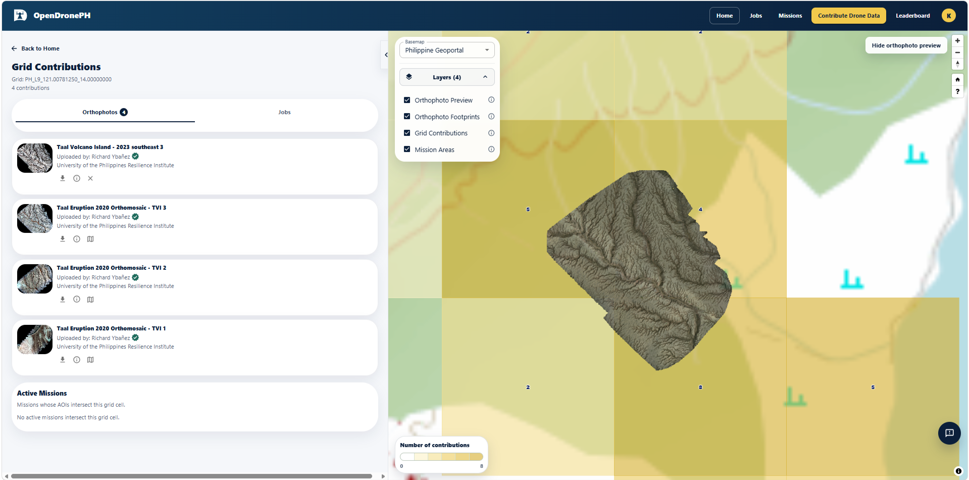
Much of UPRI’s current uploaded imagery is associated with three published studies. These cover ground deformation following the 2019 Central Luzon and Cotabato earthquakes and the 2020 Taal Volcano eruption (Ybañez et al., 2021); the distribution and characteristics of ash and other tephra deposited during Taal’s 2020 eruption (Balangue-Tarriela et al., 2022); and the destructive lahars around Taal Lake triggered by Severe Tropical Storm Kristine (Trami) in October 2024 (Ybañez et al., 2026). Together, the studies document different ways that earthquakes, volcanic activity, and extreme rainfall affect communities and reshape landscapes.
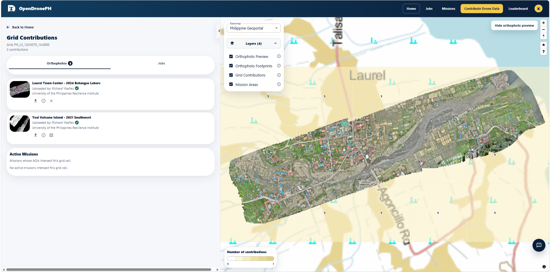
Post-disaster imagery preserves evidence that can change rapidly as deposits erode, vegetation returns, and communities undertake clearing and reconstruction in safer locations. UPRI’s research on ground deformation demonstrated this value by documenting earthquake-related features that were subsequently altered by land cultivation. Making these records accessible allows their usefulness to extend beyond the original field investigations and publications.
The shared imagery offers opportunities for further analysis, classroom exercises, and comparison with later surveys. Researchers and students can examine disaster-affected landscapes, while practitioners can draw on the records to better understand past events and support further assessments.
Explore the available imagery at opendrone.philsa.gov.ph. Access requires one-time registration. Users should acknowledge UPRI-NOAH as the data provider and cite the relevant scientific publication found in the dataset’s information page on the OpenDronePH Platform.
Related publications
- Ybañez, R. L., Ybañez, A. A. B., Lagmay, A. M. F. A., & Aurelio, M. A. (2021). Imaging ground surface deformations in post-disaster settings via small UAVs. Geoscience Letters, 8(1), 23. https://link.springer.com/article/10.1186/s40562-021-00194-8
- Balangue-Tarriela, M. I. R., Lagmay, A. M. F., Sarmiento, D. M., Vasquez, J., Baldago, M. C., Ybañez, R., … & Escudero, J. A. (2022). Analysis of the 2020 Taal Volcano tephra fall deposits from crowdsourced information and field data. Bulletin of volcanology, 84(3), 35. https://link.springer.com/article/10.1007/s00445-022-01534-y
- Ybañez, R., Ybañez, A. A., Sulapas, J. J., Serrano, L. V., Castro, A. P., Grageda, J. M. B., … & Lagmay, A. M. F. (2026). Extreme rainfall–triggered lahars from non-cone-centered sediment sources at Taal Volcano. Bulletin of Volcanology, 88(9), 104. https://link.springer.com/article/10.1007/s00445-026-02000-9