
The development of BAHAR (Baha Augmented Reality) continues, with the application undergoing field testing on May 21, 2026.
. 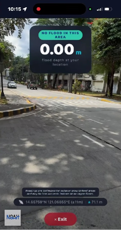
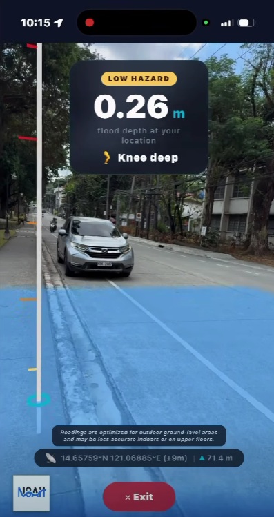
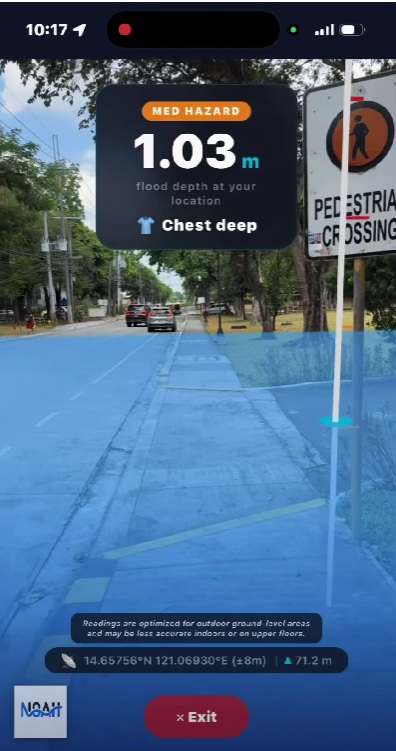
Developed through the collaborative efforts of the UPRI Research and Creative Work (RCW) Division and the UP NOAH Flood Modeling Component (FMC), BAHAR is an augmented reality (AR) application designed to make flood hazard information more accessible and easier to understand. Using a smartphone’s camera, the application overlays flood projections onto real-world environments, allowing users to visualize potential flood conditions in specific locations.
The field testing provided an opportunity to assess the application’s performance in actual settings and explore how augmented reality can be used to communicate flood hazards more effectively to the public.
The project was also highlighted during an interview on ONE News on May 22, 2026, in which Dr. Mahar Lagmay, Executive Director of the UP Resilience Institute, discussed the institute’s ongoing efforts to leverage emerging technologies, including artificial intelligence, for flood prediction and management.
During the interview, Dr. Lagmay introduced BAHAR as one of UPRI’s newest tools for flood risk communication. He explained that the application combines flood hazard information with augmented reality, enabling users to visualize potential flooding in their surroundings through their mobile devices. Designed for both Android and iOS platforms, BAHAR uses a smartphone’s camera to overlay flood projections onto real-world environments, providing users with a more intuitive way to understand flood hazards. At present, the application contains data for the University of the Philippines Diliman campus, with plans to expand coverage to Quezon City and eventually to the rest of the Philippines. He also shared that the team hopes to make the application publicly available before the onset of the rainy season.
Built on flood hazard datasets developed through the UP NOAH, BAHAR aims to transform complex geospatial information into an interactive visual experience that can help communities better understand flood risks and prepare for potential hazards. As development continues, the application reflects ongoing efforts to make science-based hazard information more accessible, engaging, and relevant to the public.
Watch the field testing video here: https://www.facebook.com/reel/839658772064383.
The full ONE News interview featuring Dr. Mahar Lagmay is available here: https://www.facebook.com/reel/966817479662156
To watch the segment where BAHAR was discussed, click here: https://www.facebook.com/reel/1699091394618111
—
For more information about BAHAR and its objectives, read our previous article: https://resilience.up.edu.ph/coming-soon-bahar-baha-augmented-reality-for-flood-risk-visualization/