
by Aira Joy C. Delos Angeles, Carl Dizon, and Jaime Broñozo

On April 19, 2026, the RURBANISE WP4 Innovation Workshop on Community Mapping and do-it-yourself (DIY) Weather Sensors was conducted at the Homeless People’s Federation Philippines, Inc. (HPFPI) Office, San Roque Parish, Subangdaku, Mandaue City. This marked the third rollout of the RURBANISE WP4 Innovation Workshop, following its earlier implementations in Kidapawan City and Davao City. The activity engaged members of the Sitio Mahayag Alliance of Structure Household (SMASH) Community in Barangay Paknaan, Mandaue City.
The workshop was organized by the University of the Philippines Resilience Institute (UPRI) in collaboration with the Technical Assistance Movement for People and Environment, Inc. (TAMPEI) and the HPFPI, through the Philippine Action for Community-led Shelter Initiatives, Inc. (PACSII), in partnership with the SMASH Community. It brought together SMASH Community members, primarily youth residents, along with Homeowners’ Association officers, other community members, and representatives from the City and Barangay Local Government Units (LGUs). This collaborative activity aimed to strengthen community-based climate and disaster resilience through participatory mapping and localized early warning systems.
Participatory 3D Mapping for Tangible Community Risk Understanding
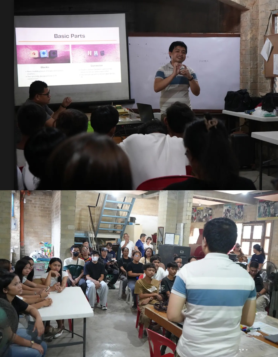
The workshop commenced with an overview of objectives delivered by Mr. Carl Dizon of the RURBANISE TechDev Team, who also facilitated the assembly and demonstration of a 3D-printed community map model. The session emphasized the importance of integrating local knowledge with technical tools to strengthen spatial understanding and support community-based disaster risk reduction.
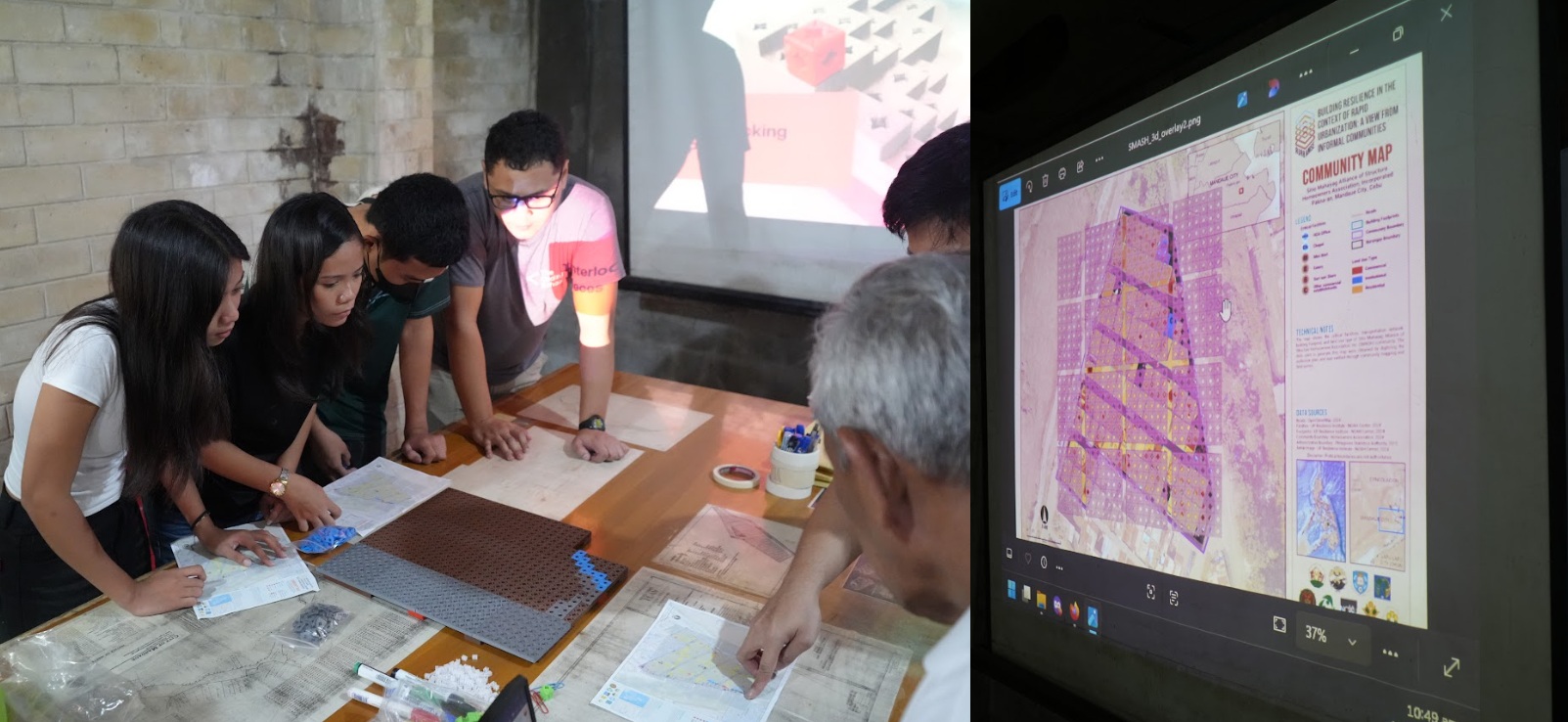
Participants from the Mandaue City Disaster Risk Reduction and Management Office (MCDRRMO), together with the Head of the Barangay Paknaan Emergency Response Team (PERT) under the Barangay Disaster Risk Reduction and Management Office (BDRRMO) of Barangay Paknaan, also participated in the exercise and were assigned to the hazard identification component. Rather than identifying isolated hazard points, they emphasized that SMASH experiences community-wide exposure to flooding and liquefaction because it is located in a reclaimed area that was formerly a body of water. Within this framing, flooding was identified as the primary hazard affecting the community, with liquefaction recognized as a significant geophysical risk.
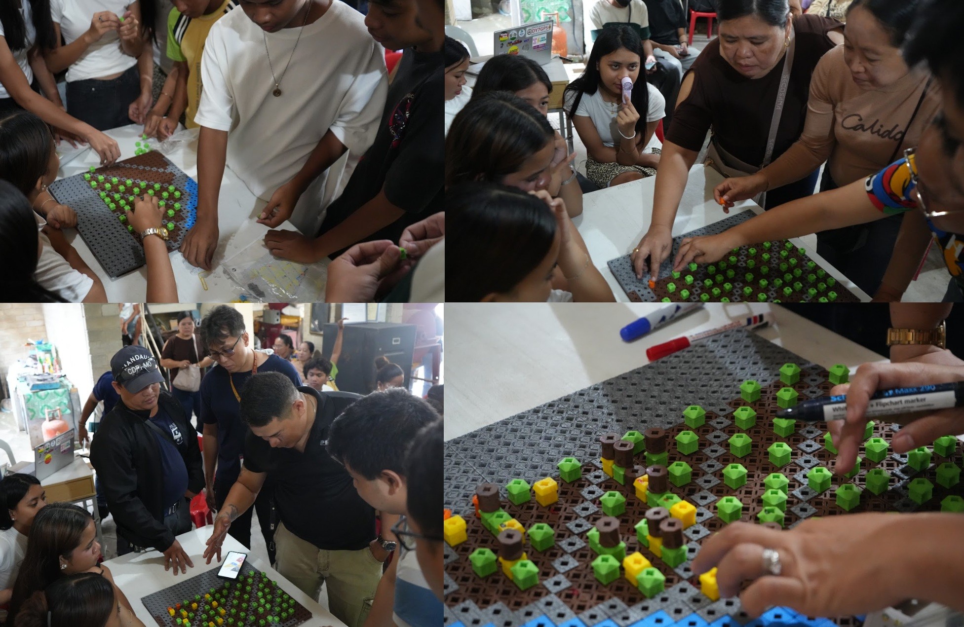
Participants engaged in a progressive, hands-on assembly of the 3D community map, transforming abstract spatial information into a tangible representation of their community. They first identified and placed markers for roads and waterways, establishing the physical and hydrological structure of SMASH. This initial layer allowed participants to visualize circulation routes, drainage flow, and access pathways within the community. They then mapped residential houses, enabling an examination of settlement patterns, housing density, and spatial clustering. Finally, key community facilities, including the community center, were identified and marked. This layered process allowed participants to understand how homes, infrastructure, and shared spaces interact to influence exposure, mobility, and evacuation dynamics during flood events. Participants reflected on past extreme weather events, including Typhoon Tinio, during which floodwaters reportedly rose above human height along roads, while in some homes, water levels reached nearly neck level. These lived experiences reinforced the understanding that risk in SMASH is systemic and affects the entire settlement.
Building on this spatial and hazard understanding, HOA members conducted household-level vulnerability mapping. Each house with vulnerable occupants was marked directly on the 3D model using a standardized color-coded system,
Brown – Children
Blue – Persons with Disabilities (PWDs)
Red – Pregnant and lactating women
Black – Elderly/senior residents
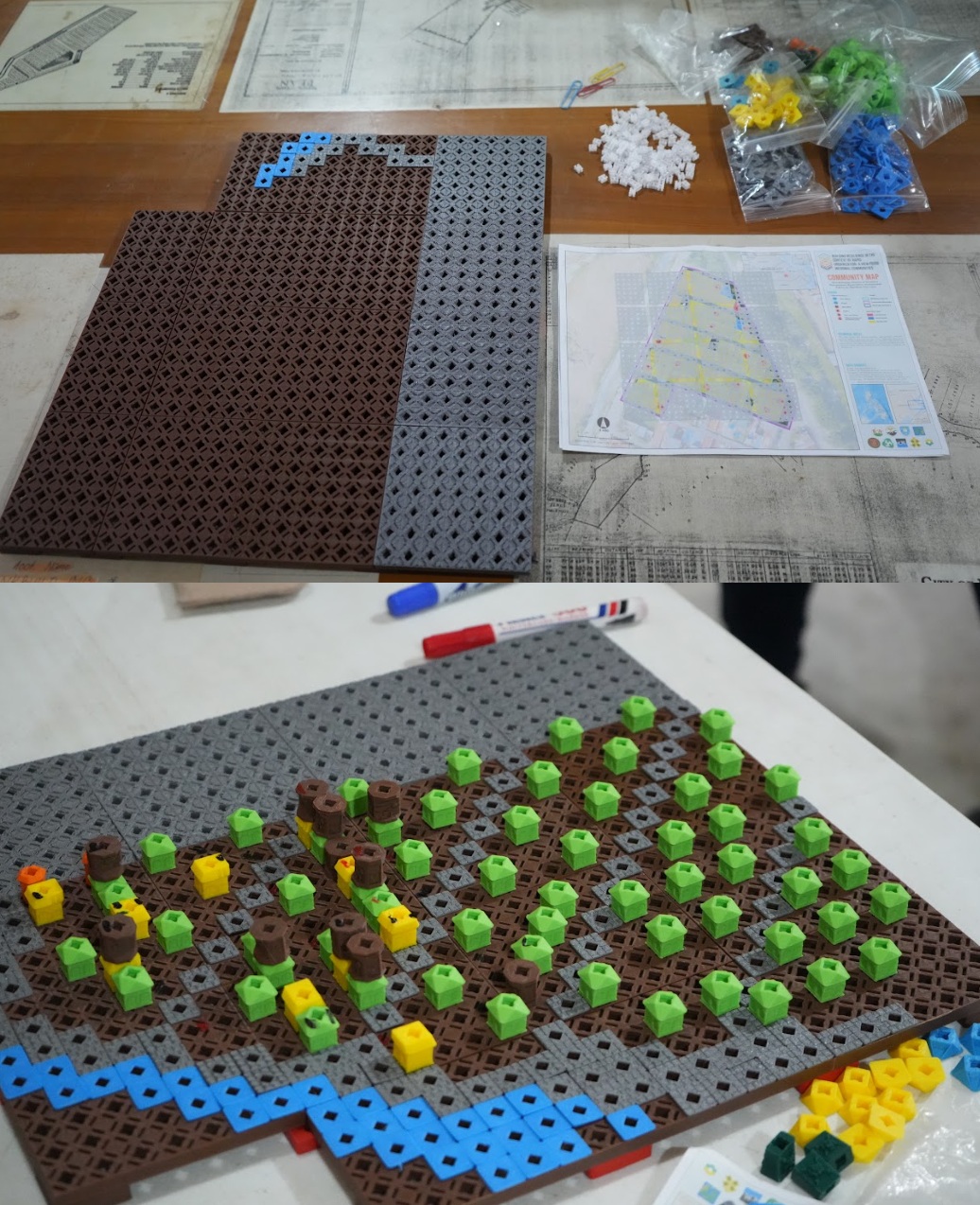
This process produced a tangible spatial representation of vulnerability distribution across SMASH. The results showed that many vulnerable individuals are concentrated near the central portion of the community, where housing density is highest. This highlights the need for targeted preparedness planning, prioritized evacuation assistance, and focused early warning communication in high-density areas. Beyond emergency preparedness, the 3D model also functioned as a practical tool for future community planning. By visually integrating houses, the community center, waterways, drainage pathways, and vulnerable households, the map can inform discussions on evacuation planning, access route improvement, drainage expansion, and long-term, risk-sensitive land use planning. During the synthesis session, Mr. Dizon emphasized the importance of translating spatial risk insights into actionable preparedness strategies, particularly ensuring that early warning information is accessible, timely, and effectively reaches vulnerable sectors.
The SMASH HOA also shared that as recently as January 2026, residents initiated the construction of a drainage system through a community-led effort supported by manpower from the local government unit (LGU), demonstrating strong local initiative in addressing flood risk.
Early Warning Systems and Inter-City Coordination
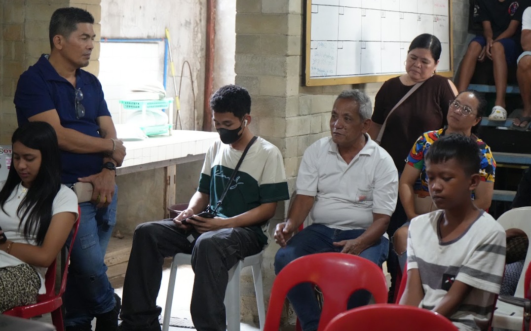
During the open forum, discussions focused on the availability and expansion of early warning systems in Barangay Paknaan. It was clarified that efforts are ongoing to expand coverage in strategic locations within the barangay. Given that SMASH is a low-lying area, flooding typically results from river overflow originating in upstream barangays. Installing early warning devices solely within Paknaan may therefore provide limited lead time for evacuation and response. A more strategic approach involves positioning monitoring systems in upstream areas to enable earlier detection and timely relay of alerts before floodwaters reach downstream communities. A key governance challenge was also identified; the river source is located in Busay, Cebu City, while Barangay Paknaan falls under the jurisdiction of Mandaue City. Strengthening coordination between the two local government units, potentially through a Memorandum of Agreement (MOA), is currently an ongoing process and was recognized as essential for improving flood monitoring, data sharing, and early warning dissemination across administrative boundaries.
Community-Based Weather Sensor Development
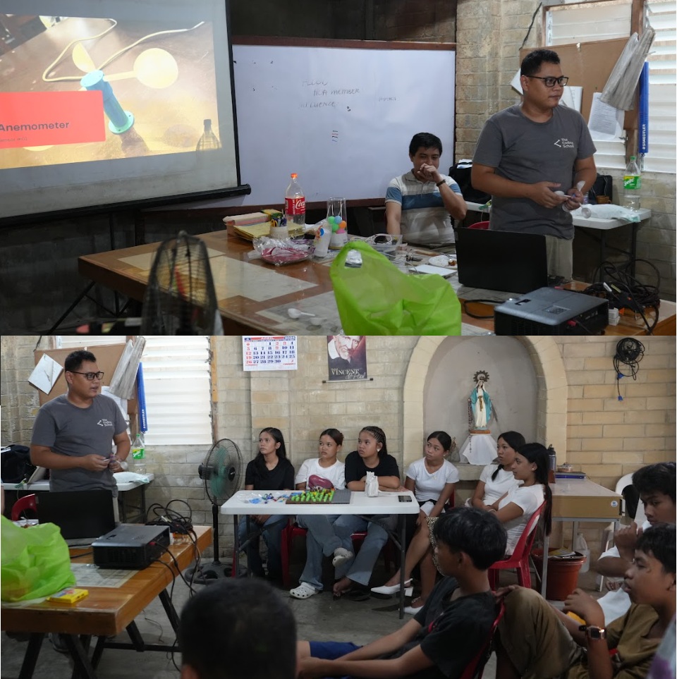
The second component of the workshop introduced participants to low-cost weather monitoring tools and their application in community-based early warning systems. This session was facilitated by Mr. Jaime Broñozo of the RURBANISE TechDev Team.
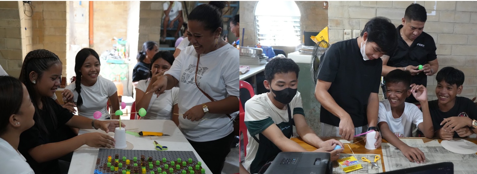
Participants were divided into groups to construct a DIY anemometer for measuring wind speed. The activity demonstrated how mechanical motion can be integrated with simple materials and components to generate usable wind speed readings.
Testing of the DIY anemometer’s effectiveness was conducted using an electronic sensing component connected to the system, enabling real-time data acquisition and visualization of wind speed readings on a computer interface. This setup allowed participants to systematically monitor and assess the output performance of the device with greater precision.
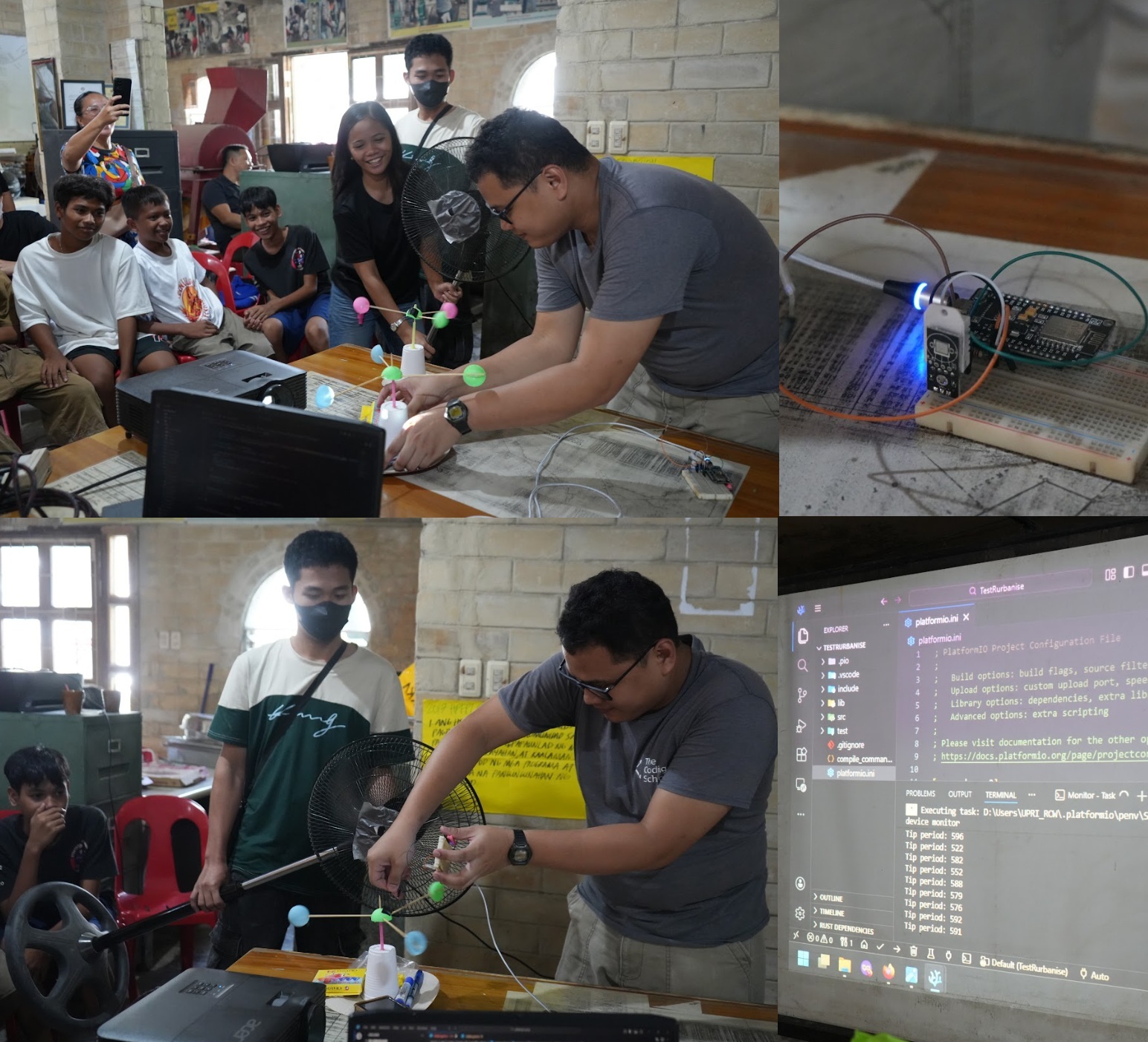
Results showed variations in performance across designs. The shorter-arm configuration produced faster rotation but yielded inconsistent readings, while the longer-arm configuration resulted in slower rotation but more stable and reliable measurements, particularly under controlled airflow conditions such as those generated by an electric fan. The exercise underscored the importance of calibration, controlled testing conditions, and minimizing mechanical resistance to improve measurement accuracy and data reliability. Participants also constructed a DIY tipping-bucket rain gauge using readily available materials such as plastic bottles, sticks, and paper plates. The mechanism demonstrated how rainfall can be measured incrementally and systematically, reinforcing the value of simple, locally built instruments in strengthening community-based climate monitoring and early warning systems.
The workshop concluded with a reflection session, where participants shared insights on wind measurement, sensor calibration, and the broader importance of community-led environmental monitoring in strengthening disaster preparedness and response capacity.
Advancing Community-Based Resilience
Through participatory mapping, hazard identification, and hands-on sensor development, the workshop underscored the importance of community engagement, tangible spatial understanding, and inter-city coordination in advancing climate and disaster resilience in the SMASH Community of Barangay Paknaan. By integrating lived experience, spatial visualization, and low-cost scientific tools, the initiative demonstrated how community-based systems can strengthen preparedness, improve early warning effectiveness, and support long-term, risk-informed planning in flood-prone communities.
—
Partner Representatives Present
The workshop was also attended by key representatives from the partner consortiums, who were present on the day of the event:
- Ar. Emelyn Bermundo, Senior Community Architect, Technical Assistance Movement for People and Environment, Inc. (TAMPEI)
- Engr. Lurebe Mae Paña, Hub Coordinator, TAMPEI
- Ar. Chara Mae Camacho-Paigan, TAMPEI
- Ms. Maria Ysabelle Pangilinan, Project Assistant, Philippine Action for Community-led Shelter Initiatives, Inc. (PACSII)
- Mr. Fidel Mariveles, Field Coordinator, PACSII
Their presence highlighted the collaborative and participatory nature of the initiative, reinforcing the value of partnership in building resilient communities.
About the RURBANISE Project
The RURBANISE Project is a multi-sectoral research initiative supported by the Climate Adaptation and Resilience (CLARE) Programme—a partnership between the United Kingdom’s Foreign, Commonwealth & Development Office (FCDO) and Canada’s International Development Research Centre (IDRC).
RURBANISE brings together six consortium partners, each contributing distinct expertise toward a shared advocacy: strengthening effective responses for climate adaptation and resilience that acknowledge and build upon the lived experiences and capacities of residents of informal settlements in the Philippines amid rapid urbanization and intensifying climate risks.
Consortium Partners
Lead Organization: Technical Assistance Movement for People and Environment, Inc. (TAMPEI)
International Academic Partner: University of Sheffield Urban Institute
Community-Led Housing: Homeless People’s Federation Philippines, Inc. (HPFPI) through Philippine Action for Community-led Shelter Initiatives, Inc. (PACSII)
Environmental Research: Institute of Environmental Science for Social Change (ESSC)
Strategic Planning and Resilience: University of the Philippines Resilience Institute (UPRI) through University of the Philippines Public Administration Foundation, Inc. (UPPAF), and the School of Urban and Regional Planning (SURP) through Planning and Development Research Foundation, Inc. (PLANADES)
Through this collaborative framework, RURBANISE advances participatory research, environmental science, strategic planning, and community-led innovation—ensuring that resilience-building efforts remain inclusive, evidence-based, and grounded in local realities.
—
Related Articles on the RURBANISE WP4 Innovation Workshop:
Mapping a Safer Future Across Generations in Nalumville, Davao City
RURBANISE Innovation Workshop Launches in HOA 1 Resettlement, Kidapawan City