
From January to July 2026, the UP Resilience Institute YouthMappers (UPRIYM), together with the UPRI-NOAH Center and the OpenStreetMap Philippines community, conducted #ChasingWaterways, a community mapping initiative to identify and map missing and hidden waterways across Quezon City.
In a highly urbanized city, waterways do not always look like waterways. Some channels are diverted, disappear beneath roads and buildings, or pass through culverts and drainage systems. Others may simply be missing from existing maps.
The project addressed a persistent challenge in urban geospatial data: small waterways, drainage channels, culverts, and modified streams can be difficult to identify from satellite imagery alone. Yet these features form part of the network through which water moves across the city, making their representation important for flood-related mapping and analysis.
To help locate these features, #ChasingWaterways combined geospatial analysis with community and local mapping knowledge. Using terrain-derived drainage networks and flood hazard data from the UPRI-NOAH Center, the initiative systematically identified potential gaps in OpenStreetMap (OSM) and directed volunteer mappers to areas that needed closer investigation.
Finding the waterways that maps miss
Terrain or elevation data are commonly used to estimate where water naturally flows. In highly urbanized areas, however, the relationship between terrain and drainage is more complicated.
Waterways may be diverted or channelized, disappear beneath roads and buildings, or pass through culverts and engineered drainage systems. Because of this, drainage networks derived from elevation data do not always correspond with waterways observable on the ground or represented in existing maps.
The #ChasingWaterways workflow used these differences as a starting point: terrain-derived drainage paths were compared with existing OSM waterways, and locations where the two did not correspond were flagged as potential mapping gaps.
Instead of asking volunteers to map the entire city, the campaign could focus on specific parts of the waterway network that needed investigation. This targeted approach helped substantially expand the mapped network within the Quezon City pilot area.
What the mapping revealed
By July 2026, 32 contributors had completed more than 1,000 mapping tasks and added 446 kilometers of waterways to OpenStreetMap. The mapped waterway network increased from approximately 185 kilometers in January to 631 kilometers by July 2026, with mapping activity accelerating particularly during June and July.
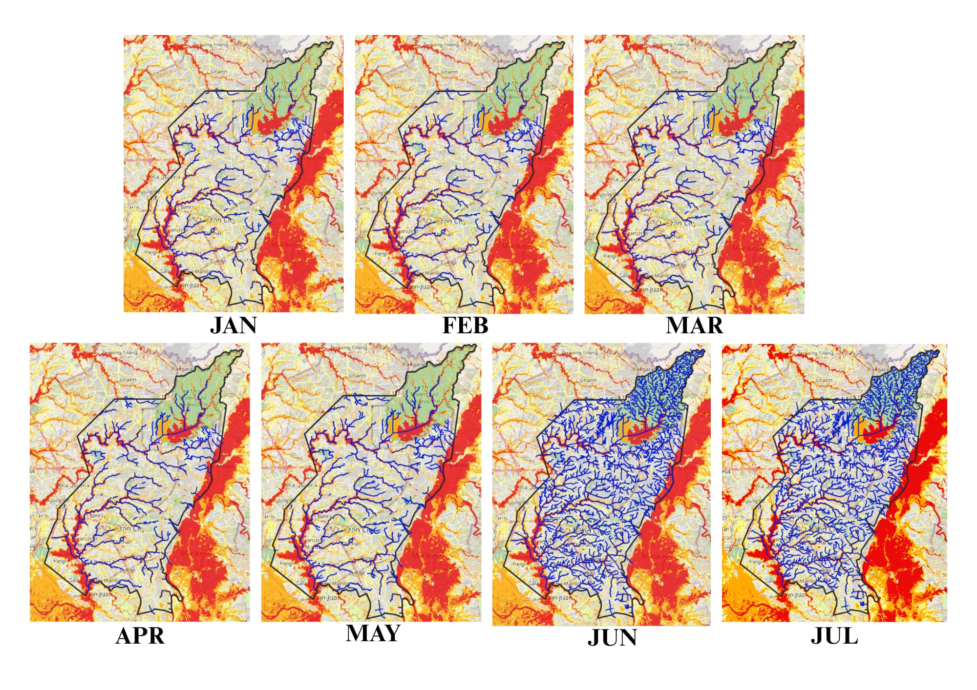
These figures represent a substantial expansion of the waterway network represented in OpenStreetMap within Quezon City. More importantly, the initiative helped build a more connected representation of the city’s waterways.
From Quezon City to other communities
Completing the Quezon City pilot marks the next stage of #ChasingWaterways. UPRIYM is now exploring how the approach can be adapted to other parts of Metro Manila and, eventually, with YouthMappers chapters and local mapping communities elsewhere in the Philippines.
Scaling the initiative will not simply mean repeating the same workflow everywhere. Different data availability, drainage systems, mapping conditions, and sources of local knowledge. The availability of suitable terrain and flood hazard data, access to reliable local information, and the need for experienced validators to review the resulting networks will shape how the approach can be adapted.
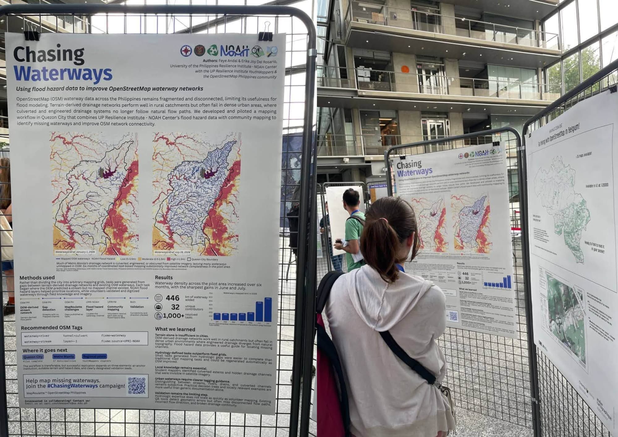
The Quezon City pilot, however, provides a starting point for bringing together scientific geospatial data, open mapping, and community knowledge to uncover parts of the urban waterway network that conventional mapping approaches can miss. The lessons from the pilot have also been extended to the international open geospatial community. #ChasingWaterways was featured at State of the Map 2026 in Paris, while related work on urban drainage mapping for flood and dengue risk was presented at FOSS4G 2026.
From Quezon City to other communities, the chase continues. We look beyond what is already on the map, find waterways that remain hidden or unmapped, and work with communities to make every waterway visible.