
Advancing climate resilience by strengthening local capacity and bridging scientific and traditional knowledge.
By: Cass Barral
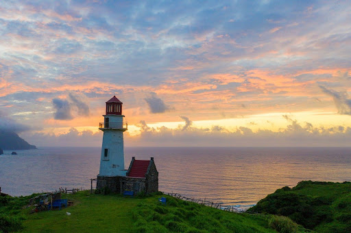
Far beyond the Luzon mainland, where powerful typhoons emerge from the Pacific and strong winds shape both the landscape and the way of life, the islands of Batanes (Figure 1) stand as a testament to resilience. For generations, the Ivatan people have adapted to geographic isolation, harsh weather conditions, and an environment that demands endurance. Yet as climate change intensifies the frequency and severity of hazards, important questions emerge: can resilience continue to rely on tradition alone? Should communities remain solely dependent on a culture of endurance in the face of increasingly complex and uncertain risks? With the wealth of information produced by government and academic institutions, the “Bridging Academic Researchers and Vulnerable Island Communities in the Philippines” (APN-Batanes Project) asserts that traditional and scientific knowledge can and should co-exist to help communities prepare for an uncertain future.
Recognizing the need to strengthen disaster resilience in Batanes, the APN-Batanes Project was launched in early 2025 with funding from the Asia-Pacific Network for Global Change Research (APN). The project is led by the University of the Philippines Resilience Institute (UP RI) in collaboration with local partners.
The initiative aims to strengthen the disaster risk management capacities of the six municipalities of Batanes—Basco, Itbayat, Ivana, Mahatao, Sabtang, and Uyugan. Beyond capacity-building, the project serves as a model for translating scientific research into practical actions that respect local knowledge and culture while supporting local governance.
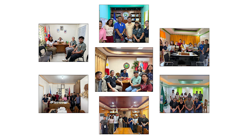
Preparatory activities commenced prior to the official launch of the project through a series of online coordination meetings between the APN–Batanes project team and stakeholders from the Provincial Government of Batanes, its six municipalities, and relevant regional line agencies. These initial engagements established communication channels, aligned expectations, and laid the groundwork for project implementation. The project was formally launched through an online inception meeting attended by project stakeholders and a representative from the funding agency. The event introduced the project’s objectives, scope, and expected outputs, while fostering a shared understanding of the roles and responsibilities of the participating institutions. Following the launch, the UP Resilience Institute’s Nationwide Operational Assessment of Hazards (NOAH) Center Planning Component, together with representatives from the Flood Modeling Component and the Hazard Assessment Team, conducted their first field mission to Batanes in May 2025. The visit began with a series of courtesy calls (Figure 2), providing an opportunity to strengthen relationships with provincial and municipal partners, reiterate the project’s objectives, express appreciation for the support of local stakeholders, and reaffirm the team’s commitment to a participatory and evidence-based approach to climate and disaster risk management in the province.
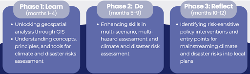
At the heart of the initiative, the “Learn–Do–Reflect” framework (Figure 3), is an experiential approach that recognizes that meaningful learning occurs when knowledge is acquired, applied, and continuously improved through reflection. Rather than treating local governments as passive recipients of technical assistance, the framework empowers them to become active partners in generating and applying knowledge for resilience.
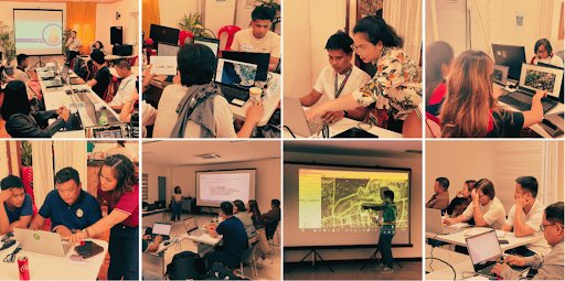
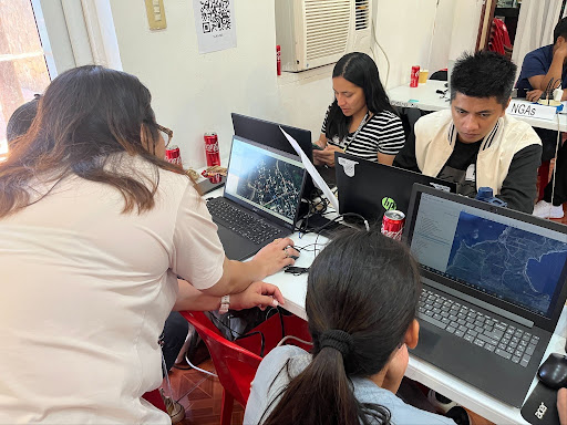
The journey began with the “Learn Phase” in 2025. Through a series of workshops (Figure 4), conducted in May and July, local government personnel from across Batanes were trained in Geographic Information Systems (GIS) and Climate and Disaster Risk Assessment (CDRA). Participants gained foundational skills in understanding hazards, exposure, and vulnerability, while learning how spatial data and risk assessments can support evidence-based planning and decision-making in their respective municipalities. These trainings equipped local planners and technical staff with tools that enable them to better understand the evolving risks facing their communities in a changing climate.
Learning, however, was only the first step. The “Do Phase” began almost right after the participants acquired theoretical knowledge. In the “Do Phase,” which started in May of 2025, participants immediately applied their newly acquired skills to a real-world planning challenge working alongside the project team, LGU personnel updated the existing land use maps of all six municipalities(Figure 5).. These maps serve as critical planning inputs, providing a clearer picture of communities, infrastructure, natural resources, and assets that may be exposed to hazards such as strong winds, flooding, and landslides. These activities transformed technical concepts from the training workshops into tangible outputs that local governments can use to guide future development decisions (Figure 6-7).
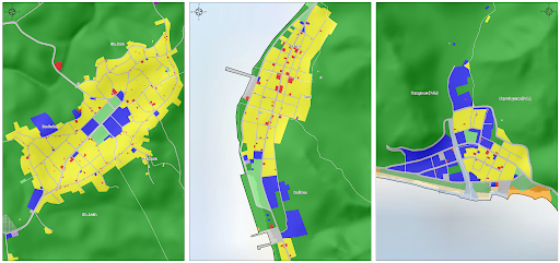
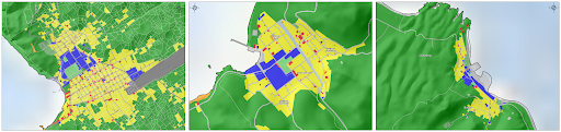
To further support the participating local government units, a series of peer-to-peer mentoring sessions were conducted throughout the project, both face-to-face and online. These sessions became spaces where technical expertise and local knowledge met and informed each other. This strengthened the LGU participants’ understanding of hazard assessment and spatial analysis, while deepening the UP RI team’s appreciation of Ivatan culture and lived practices of resilience and adaptation.
The project entered the “Reflect Phase” in April 2026. Rather than serving as a conclusion, this phase focused on presenting project outputs and facilitating a workshop to formulate Risk-Sensitive Planning Interventions (RSPI). Through structured reflection (Figure 8), local stakeholders engaged with the outputs and collaboratively identified policy interventions that translate risk information into actionable strategies. This reinforced resilience-building as an iterative process of co-developing and refining knowledge for application in local contexts.
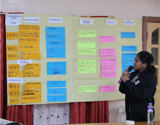
The project shows that resilience is built not only through infrastructure or emergency preparedness measures, but through the capacity of people and institutions to learn, act, and adapt. By bringing together scientific and traditional knowledge in local planning processes and empowering communities to participate in risk-informed decision-making, the “Learn–Do–Reflect” framework creates lasting impacts that honor both ways of knowing and extend beyond the project’s duration In doing so, Batanes serves as a model of how vulnerable island communities can transform knowledge into action and uncertainty into opportunity. It shows how different bodies of knowledge can coexist with mutual respect in pursuit of a shared goal, helping shape a more resilient future for generations to come (Figure 9).