Open Data Day is an annual global celebration that promotes the value of open data and encourages its use within communities. This year, it was officially observed on March 7, with various activities taking place worldwide from March 1-7. Building on this momentum, the UP Resilience Institute YouthMappers (UPRIYM) expanded the celebration into a month-long series of activities, featuring three key mapping initiatives: an OpenStreetMap (OSM) Mapping Party, the Chasing Waterways Campaign, and a mapping session with senior high school students. Over 7,000 edits, 3 mapping initiatives, and dozens of new contributors, UPRIYM celebrates Open Data Day through action.
OSM Mapping Party with TomTom
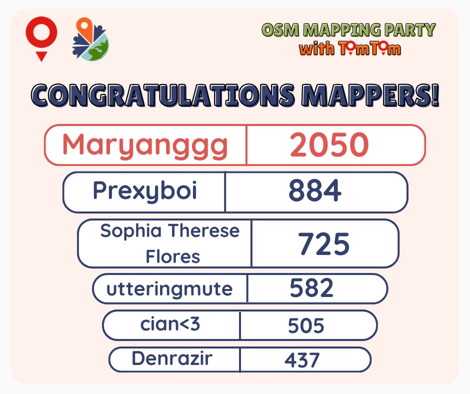
UPRIYM’s celebration kicked off on March 9 with a mapping party in collaboration with TomTom and the local YouthMappers chapters. During the session, Kiran Ahire of TomTom introduced MapRoulette, a tool that enables contributors to complete microtasks to improve map quality. The activity focused on aligning buildings and roads in OpenStreetMap to enhance the accuracy of mapped features.
Through the collective effort of 29 contributors, participants successfully completed 100% of the mapping challenges, totaling 7,495 map edits. Beyond the numbers, the activity demonstrated the power of collaborative mapping. Top and highly active mappers were also recognized and rewarded, reinforcing the value of individual contributions within a shared effort.
Mappy Hour: Supporting the Chasing Waterways Campaign
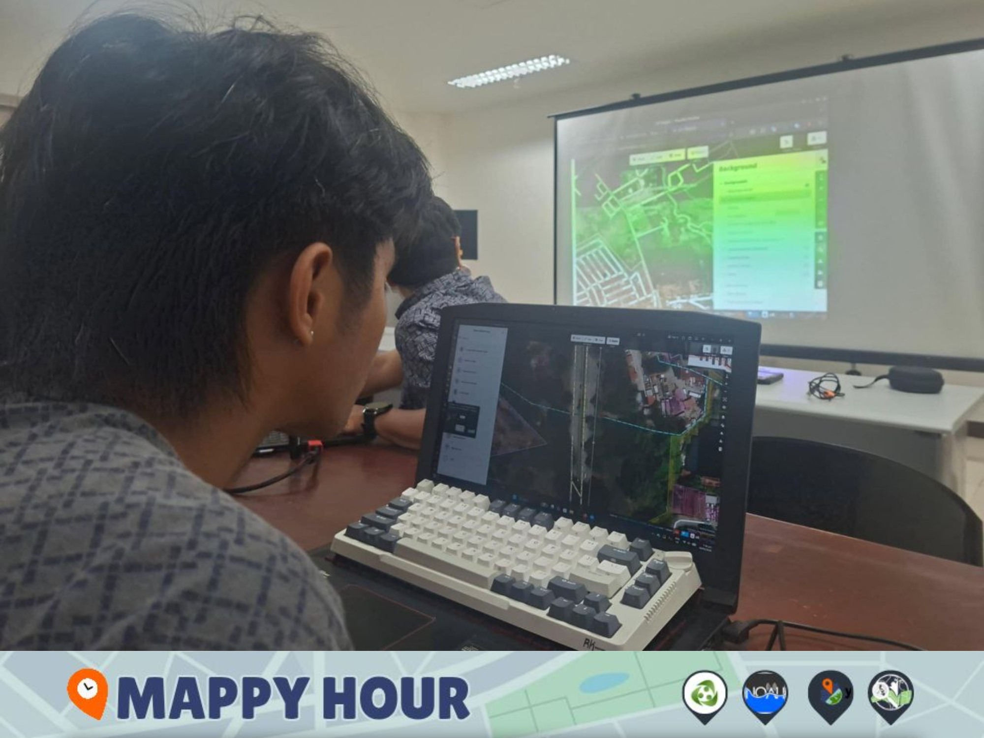
UPRIYM also hosted a “Mappy Hour” on March 16 in support of the Chasing Waterways Campaign, a community-driven initiative to improve the waterways dataset in OpenStreetMap. The session was conducted in collaboration with the OSM Philippines community, further strengthening the initiative through shared expertise and participation.
The onboarding was led by UPRIYM mentor Feye Andal, alongside OpenStreetMap advocate Erwin Olario. Participants were introduced not only to practical techniques for mapping waterways but also to tools that support the campaign’s workflow. This included MapRoulette, where mapping tasks are hosted, allowing contributors to complete targeted microtasks, and the RapiD editor, which provides convenient access to custom data layers that guide mapping efforts, such as the NOAH hazard maps.
Through these tools and guided exercises, participants strengthened both their technical skills and their understanding of local environmental data, particularly in identifying and mapping waterways that are often underrepresented.
Mapping for Resilience with BCI Marikina Students
The month-long celebration concluded with a partnership activity with Berean Crosspointe International (BCI) Marikina on March 23. UPRIYM worked with Grade 11 students in their Disaster Risk Reduction and Management class, introducing them to mapping for street-level resilience.
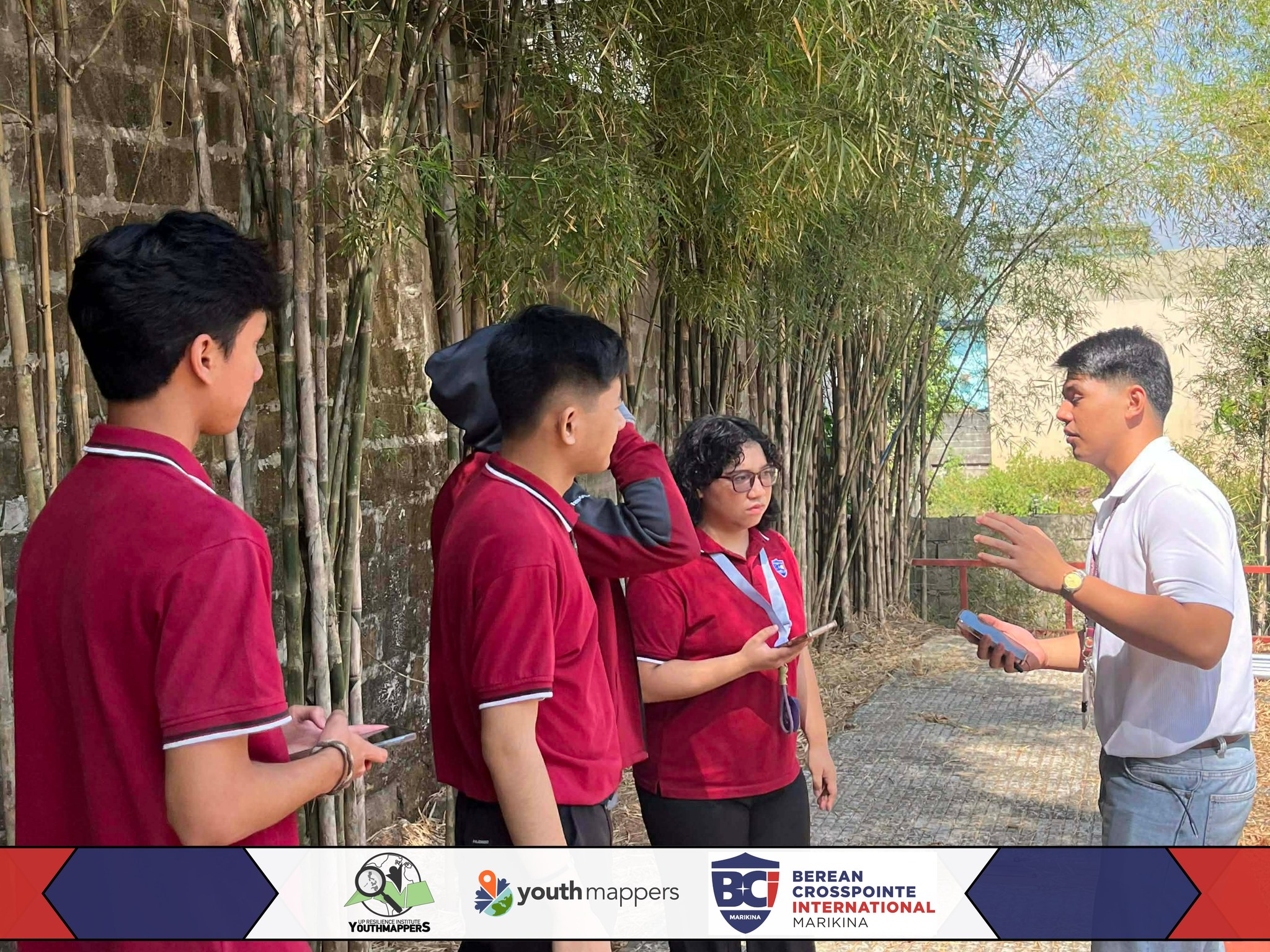
Using EveryDoor, students mapped features such as trees, drains, street lamps, benches, and other features — contributing valuable local data to areas with limited coverage in OpenStreetMap. More than a technical exercise, the session became an engaging introduction to mapping. Students actively participated and developed a deeper appreciation for how geospatial data can support safer, more resilient communities.
Building Communities Through Open Data
UPRIYM’s month-long Open Data Day celebration showcased how open data and collaborative mapping can empower diverse communities.
From experienced mappers to first-time contributors, each mapping activity showed how small, collective efforts can create a meaningful impact. Together, these initiatives highlight the growing role of open data in building more informed, resilient, and connected communities.