
by Irish John Avis, Carl Dizon, Jaime Broñozo, and Aira Joy C. Delos Angeles
Photos by Lyka Mari Napiñas
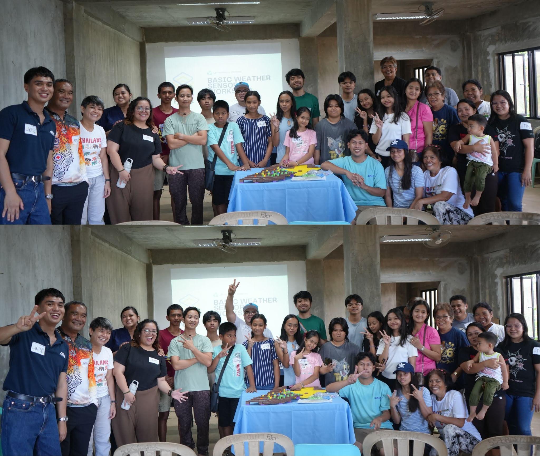
Community residents, local government representatives, and partner organizations gathered on May 3, 2026, for the fourth RURBANISE Innovation Workshop at the community evacuation center of the Canapawan Self-Initiative Development Homeowners Association, Inc. (CASIDHAI) in Labo, Camarines Norte. Organized by the UP Resilience Institute (UP RI) in collaboration with Technical Assistance Movement for People and Environment, Inc. (TAMPEI), Homeless People’s Federation Philippines, Inc. (HPFPI), Philippine Action for Community-led Shelter Initiatives, Inc. (PACSII), and the CASIDHAI community, the workshop brought together community residents alongside representatives from the Municipal Disaster Risk Reduction and Management Office (MDRRMO) of the Municipality of Labo.
The activity forms part of the continuing RURBANISE initiative on community capacity building and citizen science for disaster resilience through participatory mapping and hands-on weather sensor development. The Labo workshop marked the fourth Innovation Workshop conducted under the initiative, following earlier workshops held in Kidapawan City, Davao City, and Mandaue City.
Revisiting Community Hazard Assessment
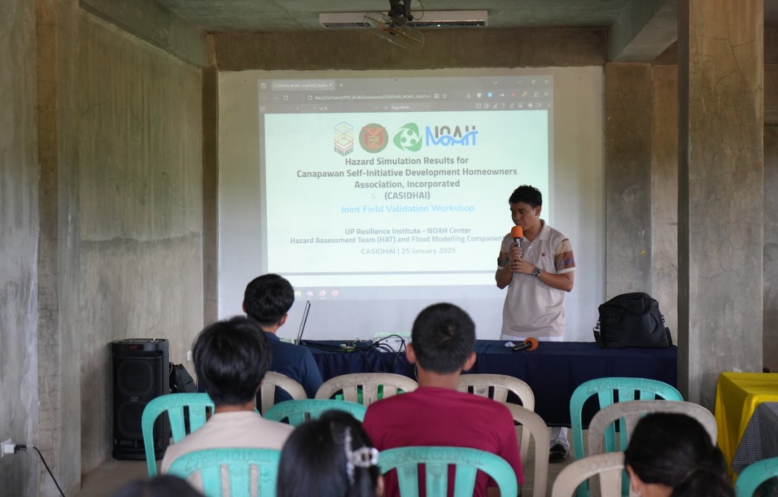
Before the workshop proper, Mr. Irish John Avis, Project Coordinator of the RURBANISE Project for UP RI, revisited the results of the community hazard assessment previously validated by CASIDHAI residents during the Joint Validation Workshop. The presentation served as a refresher on the hazards affecting the community and reinforced the importance of understanding local risks in relation to the succeeding activities involving 3D-printed maps and weather station development.
Participatory Mapping Through 3D Printed Maps
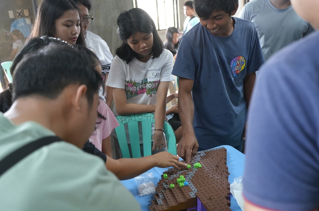
The morning session focused on participatory risk and community mapping using 3D printed maps. Community residents and MDRRMO representatives worked together to identify and map roads and waterways, residences and commercial establishments, community facilities, hazard-prone areas, and households belonging to vulnerable sectors. Through the activity, participants gained a clearer understanding of the spatial relationships within their community and how natural hazards may affect different areas and groups.
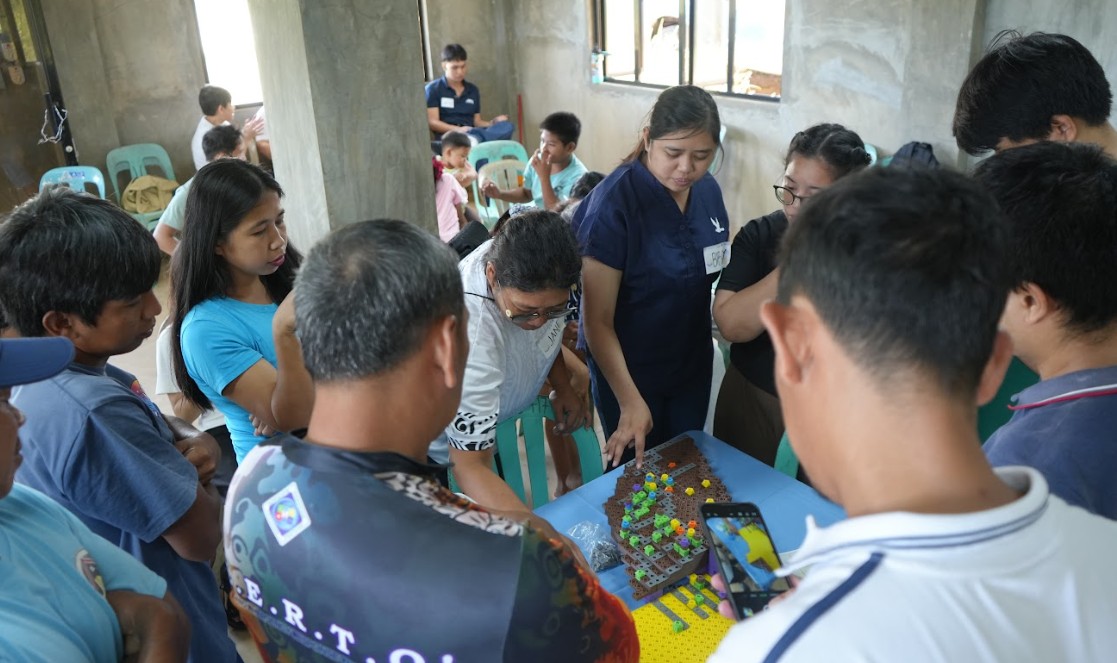
The exercise also encouraged residents to become more familiar with one another’s locations and community conditions, enabling discussions on the possible challenges they may face during hazard events. Inputs from the MDRRMO further enriched the activity by emphasizing the natural risks present in the area and their potential impacts on the community.
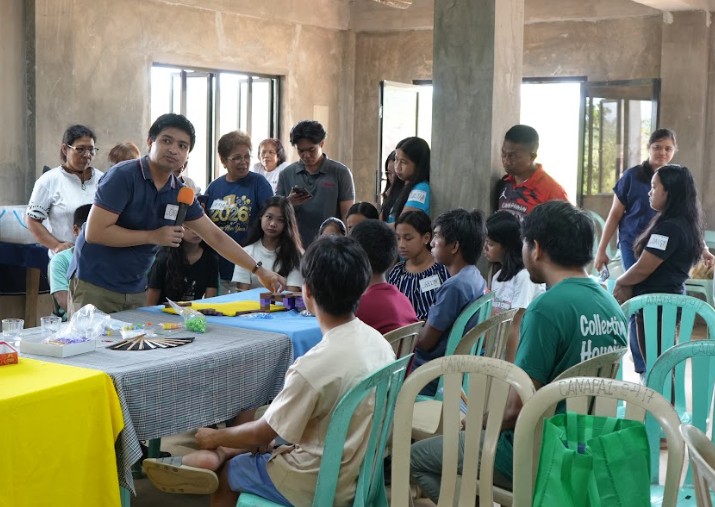
Following the mapping activity, Mr. Carl Dizon of the RURBANISE Technical Development Team presented the completed map and provided a synthesis of the community’s physical environment, natural hazards, and current concerns. The session also became an opportunity for residents to reflect on their long-term aspirations for CASIDHAI, particularly their vision of developing the area into a more organized residential community complete with street names and critical facilities. Ongoing developments, such as the construction of paved roads and a community clinic, were likewise added to the maps to provide participants with a more comprehensive picture of the community’s present condition and future direction.
Exploring Community-Based Solar Innovations
The afternoon session began with the Solar Innovation Workshop presentation, which focused on community-based renewable energy solutions. The discussion was anchored on one of the community’s identified priority concerns: independent and sustainable energy access, including the possibility of establishing a solar-powered water system.
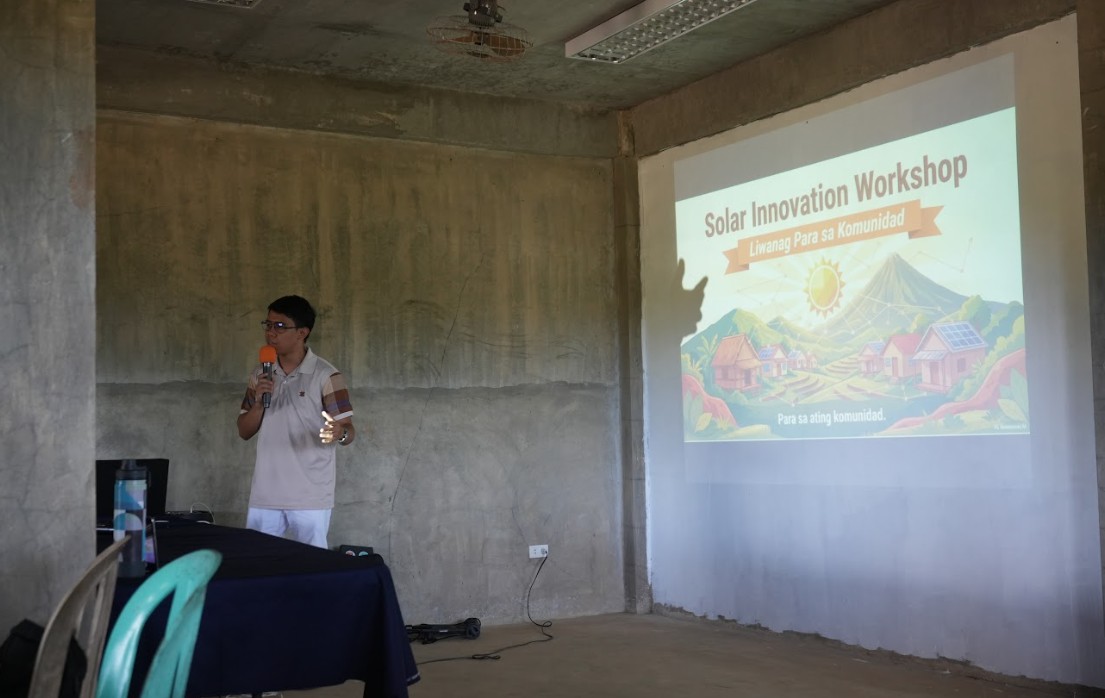
Mr. Irish John Avis presented several solar energy options that the homeowners’ association (HOA) may consider in future planning and implementation efforts. These included portable solar kits and solar charging stations that may support both household and emergency energy needs, as well as solar-powered community halls and solar rainwater harvesting systems designed to ensure the continuity of essential services during power interruptions. The presentation emphasized that these technologies were intended only as possible options and that future projects should ultimately be based on the actual needs and capacities of the community. He also introduced potential funding opportunities from barangays, local government units, national government agencies such as the Department of Science and Technology (DOST), the People’s Survival Fund (PSF) under the Department of Finance (DOF), and non-government organizations.
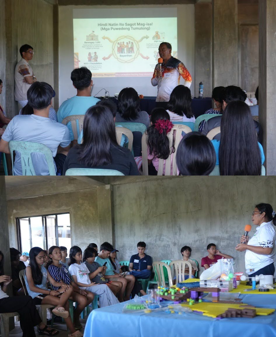
During the discussion, barangay and local government representatives acknowledged the concerns and proposed initiatives of the HOA, particularly regarding solar-related projects. They also expressed their willingness to support the community through partnerships for future planning and implementation efforts, subject to their respective priorities and available resources. UP RI, TAMPEI, and PACSII likewise emphasized their commitment to assisting the HOA in communicating its needs and exploring possible support from relevant institutions and partner organizations.
Hands-on Weather Sensor Development
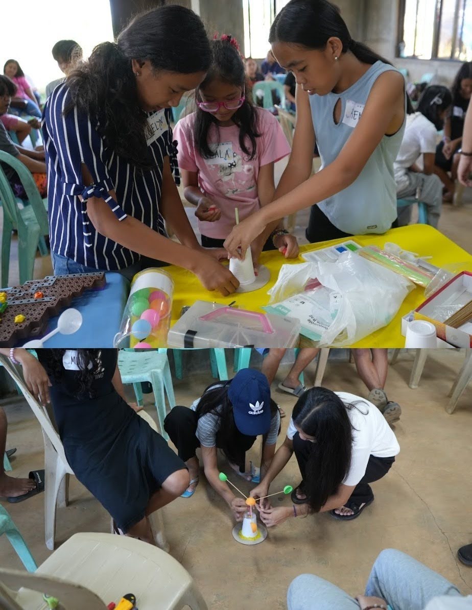
The final segment of the workshop focused on the development of simple weather sensors through a hands-on citizen science activity. Youth participants assembled basic weather instruments such as DIY anemometers, thermometers, and rain gauges using craft and recycled materials. The activity introduced practical methods for observing weather conditions and collecting environmental data using simple tools that can be recreated within the community.
The workshop also demonstrated how these weather sensors may support the community’s plans for rainwater harvesting and water sustainability by helping residents monitor rainfall patterns and estimate potential water collection capacity. Through the activity, participants were introduced to the idea of utilizing accessible and community-driven technologies to strengthen environmental awareness and disaster preparedness.
Strengthening Community Resilience Through Innovation
By linking participatory mapping, renewable energy discussions, and weather sensor development with the community’s identified concerns, the Innovation Workshop enabled residents to better understand their environment and explore practical pathways toward resilience and sustainability.
The strong interest of the CASIDHAI community in permanently displaying the 3D-printed maps and exploring the possible acquisition of a basic weather station further demonstrated the relevance of the workshop activities to their long-term plans. Through the integration of local knowledge, participatory approaches, and accessible technologies, the workshop highlighted the potential of community-driven innovation in strengthening disaster resilience and supporting a safer and more sustainable future for CASIDHAI.
—
Partner Representatives Present
The workshop was also attended by key representatives from the partner consortiums, who were present on the day of the event:
- Ar. EnP. Louie Robert Posadas, Executive Director, Technical Assistance Movement for People and Environment, Inc. (TAMPEI)
- Ar. Emelyn Bermundo, Senior Community Architect, TAMPEI
- Ar. Ruel Orcajada, Core Program Manager, TAMPEI
- Engr. Lurebe Mae Paña, Technical Assistant and Hub Coordinator, TAMPEI
- Ms. Lheanne Begino, TAMPEI
- Ms. Maria Ysabelle Pangilinan, Project Assistant, Philippine Action for Community-led Shelter Initiatives, Inc. (PACSII)
- Mr. Wise Castañeda, PACSII
Their presence highlighted the collaborative and participatory nature of the initiative, reinforcing the value of partnership in building resilient communities.
About the RURBANISE Project
The RURBANISE Project is a multi-sectoral research initiative supported by the Climate Adaptation and Resilience (CLARE) Programme—a partnership between the United Kingdom’s Foreign, Commonwealth & Development Office (FCDO) and Canada’s International Development Research Centre (IDRC).
RURBANISE brings together six consortium partners, each contributing distinct expertise toward a shared advocacy: strengthening effective responses for climate adaptation and resilience that acknowledge and build upon the lived experiences and capacities of residents of informal settlements in the Philippines amid rapid urbanization and intensifying climate risks.
Consortium Partners
Lead Organization: Technical Assistance Movement for People and Environment, Inc. (TAMPEI)
International Academic Partner: University of Sheffield Urban Institute
Community-Led Housing: Homeless People’s Federation Philippines, Inc. (HPFPI) through Philippine Action for Community-led Shelter Initiatives, Inc. (PACSII)
Environmental Research: Institute of Environmental Science for Social Change (ESSC)
Strategic Planning and Resilience: University of the Philippines Resilience Institute (UPRI) through University of the Philippines Public Administration Foundation, Inc. (UPPAF), and the School of Urban and Regional Planning (SURP) through Planning and Development Research Foundation, Inc. (PLANADES)
Through this collaborative framework, RURBANISE advances participatory research, environmental science, strategic planning, and community-led innovation—ensuring that resilience-building efforts remain inclusive, evidence-based, and grounded in local realities.
—
Related Articles on the RURBANISE WP4 Innovation Workshop:
- RURBANISE Innovation Workshop Launches in HOA 1 Resettlement, Kidapawan City
- Mapping a Safer Future Across Generations in Nalumville, Davao City
- Bridging Local Expertise and Technical Innovation to Strengthen Multi-Hazard Preparedness and Community-Based Early Warning Systems in Mandaue City, Cebu